File:Forstabteilungsnummern.png
Forstabteilungsnummern.png (256 × 256 pixels, file size: 8 KB, MIME type: image/png)
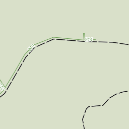
Example rendering of incompletely mapped forest sections (or Management Compartments) German: Forstabteilungsnummer, Jagenzahl, Jagennummer, Forstliches Abteilungsnetz
- This media file was uploaded by author of the work and its copyright holder.
![]()
![]()
The person who associated a work with this deed has dedicated the work to the public domain by waiving all of his or her rights to the work worldwide under copyright law, including all related and neighboring rights, to the extent allowed by law. You can copy, modify, distribute and perform the work, even for commercial purposes, all without asking permission.
This map rendering is from my own "hikebikemap" style (Hike & Bike Map, https://github.com/cmarqu/hikebikemap-carto).
File history
Click on a date/time to view the file as it appeared at that time.
| Date/Time | Thumbnail | Dimensions | User | Comment | |
|---|---|---|---|---|---|
| current | 19:43, 2 January 2010 | | 256 × 256 (8 KB) | Colin Marquardt (talk | contribs) | Example rendering of incompletely mapped forest sections (or Management Compartments) German: Forstabteilungsnummer, Jagenzahl, Jagennummer, Forstliches Abteilungsnetz |
You cannot overwrite this file.
File usage
The following page uses this file: