File:French power vectors simplification.png
Original file (1,651 × 723 pixels, file size: 336 KB, MIME type: image/png)
Summary
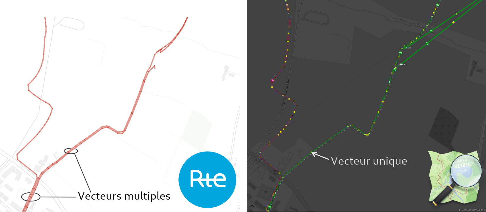
Simplification of underground power lines with official opendata provided by RTE
François Lacombe www.infos-reseaux.com
Licensing
![]()
![]()
![]()
Attribution not specified as a parameter! THIS LICENSE ALWAYS REQUIRES ATTRIBUTION! Use {{CC-BY-SA-4.0|Attribution, typically name of author}} See Template:CC-BY-SA-4.0 for full description this template should be used.

|
™ OpenStreetMap Foundation This file is (or includes) one of the official logos or designs used by the OpenStreetMap Foundation or by one of its projects. Use of the OpenStreetMap Foundation logos, trademarks and servicemarks may require permission by OpenStreetMap Foundation. If you have questions about your use of the marks, please send your questions to the Licence Working Group of OpenStreetMap Foundation. For more information see the Trademark Policy. |
File history
Click on a date/time to view the file as it appeared at that time.
| Date/Time | Thumbnail | Dimensions | User | Comment | |
|---|---|---|---|---|---|
| current | 18:17, 19 April 2020 | | 1,651 × 723 (336 KB) | Fanfouer (talk | contribs) | Simplification of underground power lines with official opendata provided by RTE François Lacombe www.infos-reseaux.com |
You cannot overwrite this file.
File usage
There are no pages that use this file.