File:GADM vs OSM - Central Quezon City.png
Jump to navigation
Jump to search

No higher resolution available.
GADM_vs_OSM_-_Central_Quezon_City.png (767 × 592 pixels, file size: 35 KB, MIME type: image/png)
Information
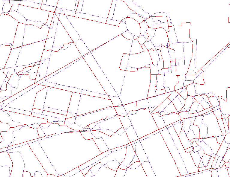
| Description | This is a comparison of the administrative boundary data between GADM and OpenStreetMap in the central Quezon City area. Red is GADM and blue is OSM. |
|---|---|
| Author | seav |
| Source | Rendered from OSM and GADM data |
| Date | 2011-03-26 |
| Permission | Fair use |
File history
Click on a date/time to view the file as it appeared at that time.
| Date/Time | Thumbnail | Dimensions | User | Comment | |
|---|---|---|---|---|---|
| current | 05:14, 20 May 2011 | | 767 × 592 (35 KB) | Seav (talk | contribs) | ==Information== {{Information |Description = Comparison of the administrative boundary data between GADM and OpenStreetMap |Source = Rendered from OSM and GADM data |Author = seav |Date = 2011-03-26 |Permission |
You cannot overwrite this file.
File usage
There are no pages that use this file.