File:Geländer am Kulturhaus im Kinderdorf Dittrichshütte 2.JPG
Jump to navigation
Jump to search


Size of this preview: 800 × 600 pixels. Other resolutions: 320 × 240 pixels | 640 × 480 pixels | 1,024 × 768 pixels | 1,280 × 960 pixels | 2,560 × 1,920 pixels | 4,896 × 3,672 pixels.
Original file (4,896 × 3,672 pixels, file size: 7.11 MB, MIME type: image/jpeg)
This file and its description are from Wikimedia Commons.
Summary
| Description |
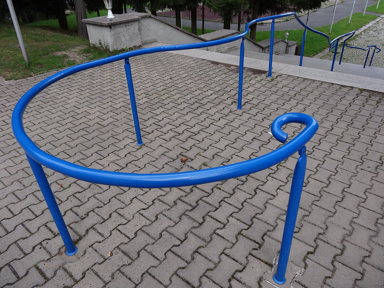
Deutsch: Geländer am Kulturhaus im Kinderdorf Dittrichshütte, Saalfelder Höhe, Thüringen English: Handrail at a house of the Kinderdorf Dittrichshütte, Thuringia, Germany |
| Date | |
| Source | Own work |
| Author | Aschroet |
| Camera location | | View this and other nearby images on: OpenStreetMap |
|---|
Licensing
| This file is made available under the Creative Commons CC0 1.0 Universal Public Domain Dedication. | |
| The person who associated a work with this deed has dedicated the work to the public domain by waiving all of their rights to the work worldwide under copyright law, including all related and neighboring rights, to the extent allowed by law. You can copy, modify, distribute and perform the work, even for commercial purposes, all without asking permission.
|
File history
Click on a date/time to view the file as it appeared at that time.
| Date/Time | Thumbnail | Dimensions | User | Comment | |
|---|---|---|---|---|---|
| current | 18:17, 14 September 2014 | | 4,896 × 3,672 (7.11 MB) | wikimediacommons>Aschroet | User created page with UploadWizard |
File usage
The following 55 pages use this file:
- Ar:Map Features
- Az:Map Features
- Cs:Key:barrier
- Cs:Map Features
- Cs:Tag:barrier=handrail
- Da:Map Features
- El:Map Features
- Hu:Key:barrier
- Hu:Map Features
- Key:barrier
- Pl:Tag:barrier=handrail
- Pt:Key:barrier
- Pt:Map Features
- Pt:Tag:barrier=handrail
- Ro:Map Features
- Tag:barrier=handrail
- Uk:Key:barrier
- Uk:Tag:barrier=handrail
- Uk:Об'єкти мапи
- Zh-hant:Map Features
- User:Gmbo/Motorrad
- Wiki:Files used by data items/2
- Template:Ar:Map Features:barrier
- Template:Az:Map Features:barrier
- Template:Cs:Map Features:barrier
- Template:DE:Map Features:barrier
- Template:Da:Map Features:barrier
- Template:El:Map Features:barrier
- Template:Et:Map Features:barrier
- Template:Generic:ES:Map Features:barrier
- Template:Generic:Map Features:barrier
- Template:Hu:Map Features:barrier
- Template:JA:Map Features:barrier
- Template:NL:Map Features:barrier
- Template:Pl:Generic:Map Features:barrier
- Template:Pt:Map Features:barrier
- Template:RU:Generic:Map Features:barrier
- Template:Ro:Map Features:barrier
- Template:Sv:Map Features:barrier
- Template:Uk:Map Features:barrier
- Template:Zh-hant:Map Features:barrier
- DE:Key:barrier
- DE:Map Features
- DE:Tag:barrier=handrail
- FR:Tag:barrier=handrail
- ES:Tag:barrier=handrail
- IT:Tag:barrier=handrail
- NL:Kaartelementen
- NL:Key:barrier
- RU:Key:barrier
- RU:Tag:barrier=handrail
- RU:Объекты карты
- JA:Key:barrier
- JA:Map Features
- JA:Tag:barrier=handrail