File:GenCat SIGPAC Landuses.jpg
Jump to navigation
Jump to search

Size of this preview: 594 × 600 pixels. Other resolutions: 238 × 240 pixels | 475 × 480 pixels | 761 × 768 pixels | 1,140 × 1,151 pixels.
Original file (1,140 × 1,151 pixels, file size: 243 KB, MIME type: image/jpeg)
Summary
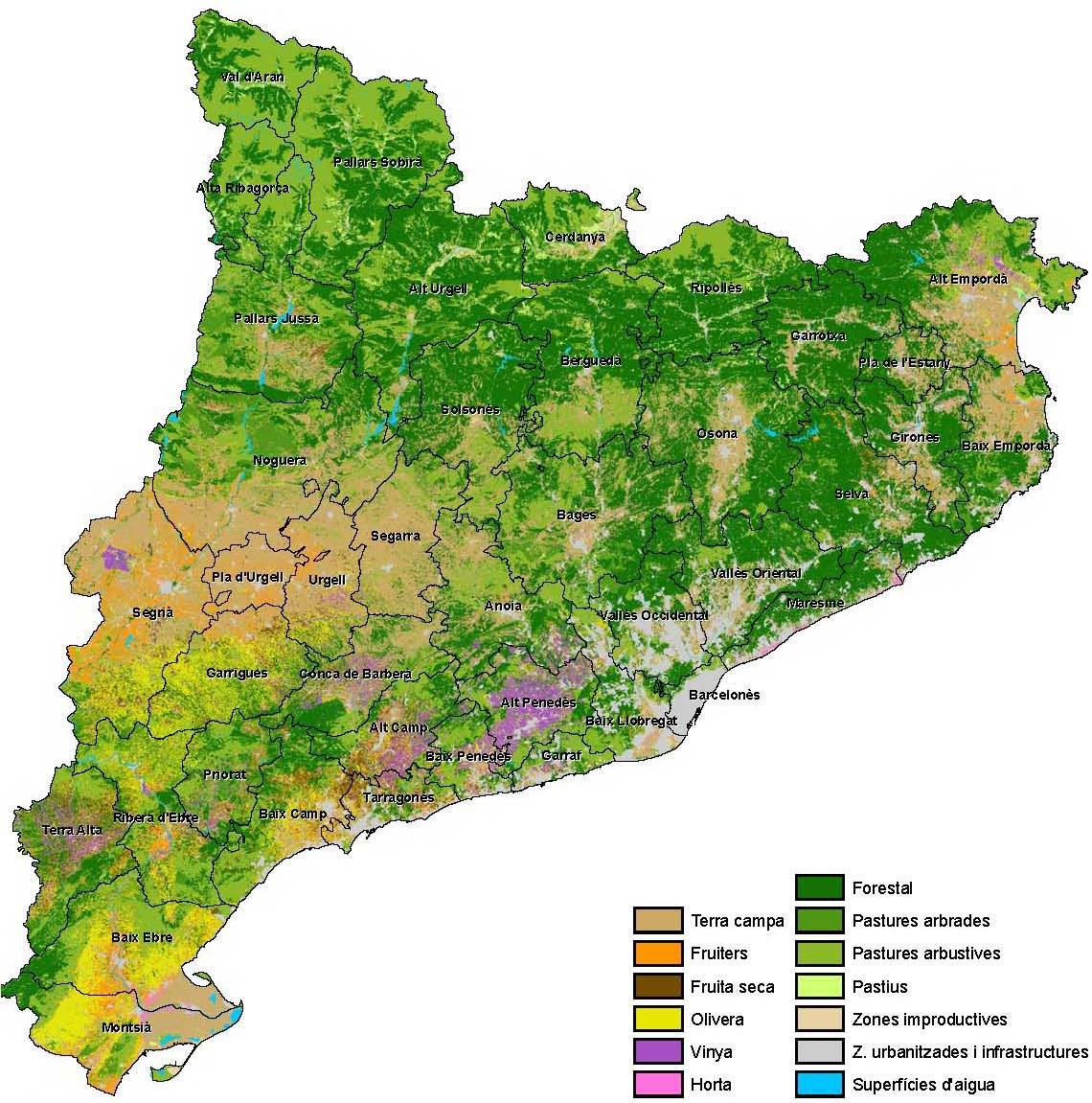
Landuses of Catalonia grouped by SIGPAC categories.
Data source: Government of Catalonia. Department of Agriculture, Livestock, Fisheries and Food.
Licensing

The copyright holder of this file allows anyone to use it for any purpose, provided that the copyright holder is properly attributed. Redistribution, derivative work, commercial use, and all other use is permitted.
If you are the uploader, please provide proper attribution including source and name of author.
If you are the uploader, please provide proper attribution including source and name of author.
File history
Click on a date/time to view the file as it appeared at that time.
| Date/Time | Thumbnail | Dimensions | User | Comment | |
|---|---|---|---|---|---|
| current | 17:35, 6 March 2019 | | 1,140 × 1,151 (243 KB) | Javirg (talk | contribs) | Landuses of Catalonia grouped by SIGPAC categories. Data source: Government of Catalonia. Department of Agriculture, Livestock, Fisheries and Food. |
You cannot overwrite this file.
File usage
There are no pages that use this file.