File:GpsMaster Screenshot Photos.png
Jump to navigation
Jump to search

Size of this preview: 800 × 375 pixels. Other resolutions: 320 × 150 pixels | 640 × 300 pixels | 1,024 × 480 pixels | 1,783 × 836 pixels.
Original file (1,783 × 836 pixels, file size: 839 KB, MIME type: image/png)
Summary
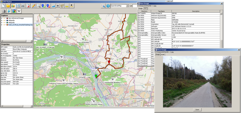
GpsMaster: Map showing the locations of nearby wikipedia articles and geotagged photos. Imageviewer with EXIF data is showing.
Licensing
![]()
![]()
![]()
This work is licensed under the Creative Commons Attribution-ShareAlike 2.0 License.
Attribution not specified as a parameter! THIS LICENSE ALWAYS REQUIRES ATTRIBUTION! Use {{CC-BY-SA-2.0|Attribution, typically name of author}} See Template:CC-BY-SA-2.0 for full description how this template should be used.
Note, there is
There is also
Attribution not specified as a parameter! THIS LICENSE ALWAYS REQUIRES ATTRIBUTION! Use {{CC-BY-SA-2.0|Attribution, typically name of author}} See Template:CC-BY-SA-2.0 for full description how this template should be used.
Note, there is
{{CC-BY-SA-2.0 OpenStreetMap}} for files based on old OSM map data, before the license change made on 2012-09-12.There is also
{{OSM Carto screenshot||old_license}} for files based on old OSM map data, before the license change made on 2012-09-12, created using OSM Carto map style.
Base map (data and cartography): © OpenStreetMap contributors
File history
Click on a date/time to view the file as it appeared at that time.
| Date/Time | Thumbnail | Dimensions | User | Comment | |
|---|---|---|---|---|---|
| current | 15:07, 30 June 2014 | | 1,783 × 836 (839 KB) | Rfuegen (talk | contribs) | wtf?! |
| 15:07, 30 June 2014 | 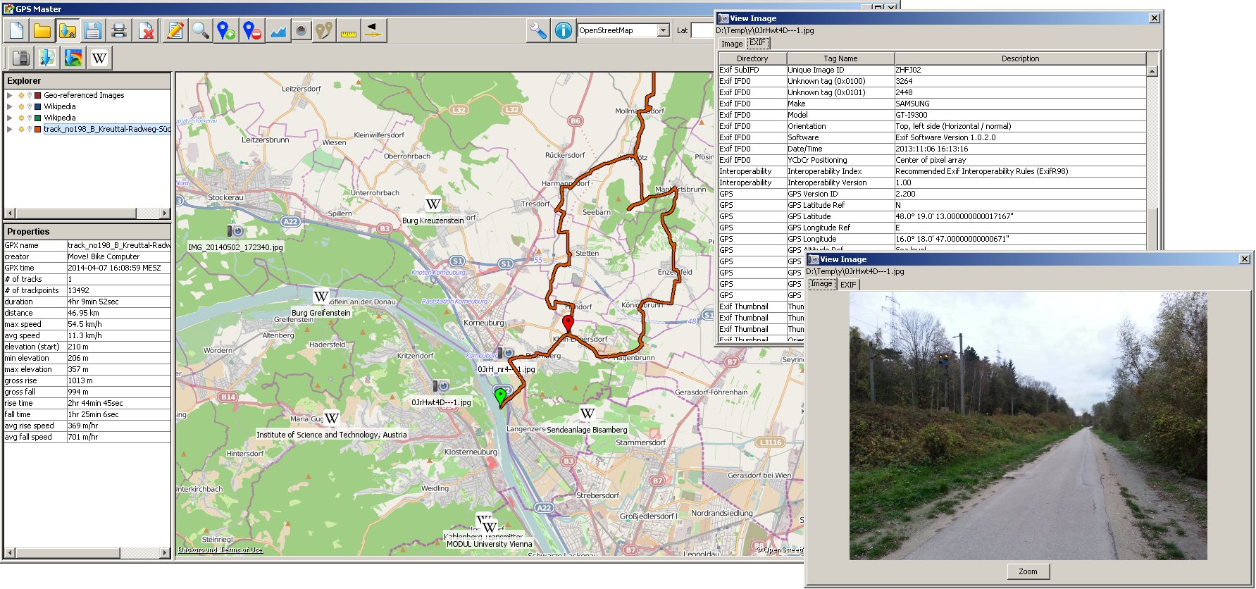 | 1,783 × 836 (839 KB) | Rfuegen (talk | contribs) | Reverted to version as of 15:04, 30 June 2014 | |
| 15:06, 30 June 2014 |  | 1,783 × 836 (839 KB) | Rfuegen (talk | contribs) | added Photo/Exif windows | |
| 15:04, 30 June 2014 |  | 1,783 × 836 (839 KB) | Rfuegen (talk | contribs) | added Photo/Exif windows | |
| 21:12, 9 April 2014 |  | 1,280 × 800 (173 KB) | Rfuegen (talk | contribs) | GpsMaster: Map showing the locations of geo-tagged photos. |
You cannot overwrite this file.
File usage
The following 3 pages use this file: