File:Greater nottingham areas osm.png
Jump to navigation
Jump to search


Size of this preview: 552 × 599 pixels. Other resolutions: 221 × 240 pixels | 442 × 480 pixels | 810 × 879 pixels.
Original file (810 × 879 pixels, file size: 610 KB, MIME type: image/png)
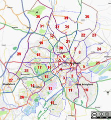
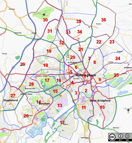
Greater Nottingham Area divided into mapping 'cake slices'.
File history
Click on a date/time to view the file as it appeared at that time.
| Date/Time | Thumbnail | Dimensions | User | Comment | |
|---|---|---|---|---|---|
| current | 12:50, 18 February 2009 | | 810 × 879 (610 KB) | SK53 (talk | contribs) | Division of the Greater Nottingham area into districts for monitoring OSM status. |
| 15:55, 5 February 2009 | 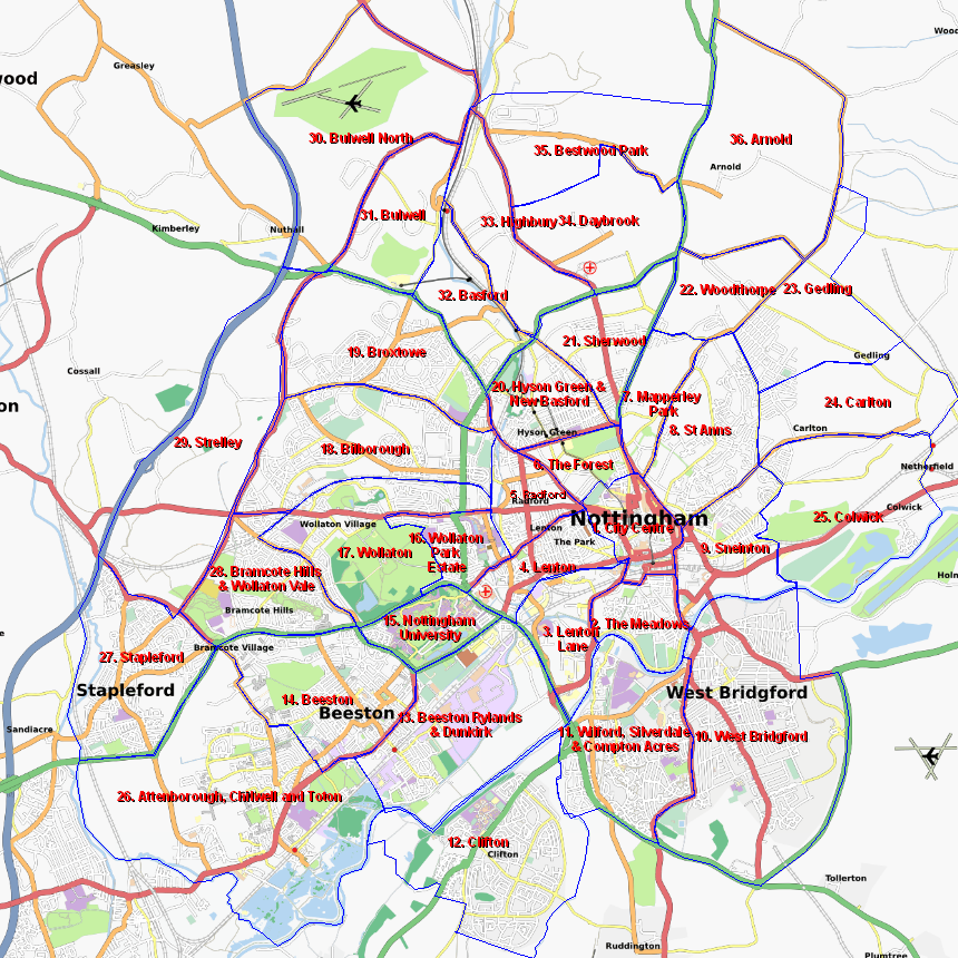 | 860 × 860 (630 KB) | SK53 (talk | contribs) | ||
| 14:37, 5 February 2009 | 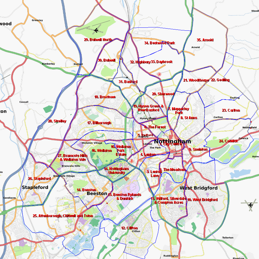 | 869 × 869 (634 KB) | SK53 (talk | contribs) | Greater Nottingham Area divided into mapping 'cake slices'. |
You cannot overwrite this file.
File usage
The following page uses this file: