File:Helgasjon.png
Jump to navigation
Jump to search

No higher resolution available.
Helgasjon.png (363 × 585 pixels, file size: 25 KB, MIME type: image/png)
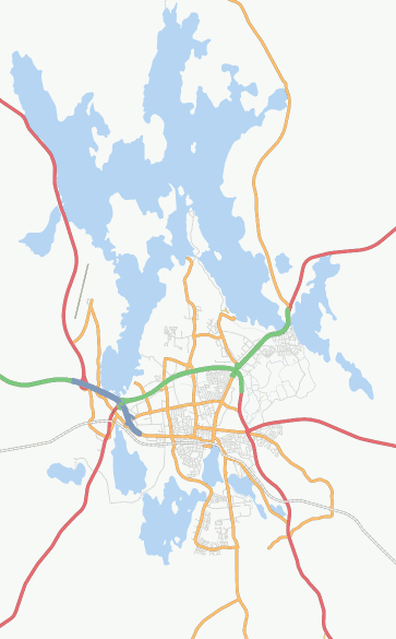
Screenshot of Osmarender layer at zoom=11, showing city Växjö in Sweden and the lake Helgasjön, link.
![]()
Contains map data © OpenStreetMap contributors, made available under the terms of the Creative Commons Attribution-ShareAlike 2.0 (CC-BY-SA-2.0).
File history
Click on a date/time to view the file as it appeared at that time.
| Date/Time | Thumbnail | Dimensions | User | Comment | |
|---|---|---|---|---|---|
| current | 23:40, 10 March 2008 | | 363 × 585 (25 KB) | LA2 (talk | contribs) | Screenshot of Osmarender layer at zoom=11, showing city Växjö in Sweden and the lake Helgasjön, [http://informationfreeway.org/?lat=56.91318611658695&lon=14.80050307075305&zoom=11&layers=B000F000F link]. |
You cannot overwrite this file.
File usage
The following page uses this file: