File:Hydropower underground water drains map.jpg
Jump to navigation
Jump to search
Size of this preview: 800 × 500 pixels. Other resolutions: 320 × 200 pixels | 640 × 400 pixels | 1,024 × 640 pixels | 1,280 × 800 pixels | 2,183 × 1,364 pixels.
Original file (2,183 × 1,364 pixels, file size: 2.18 MB, MIME type: image/jpeg)
Summary
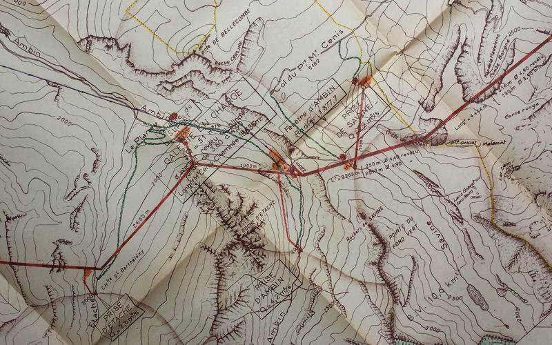
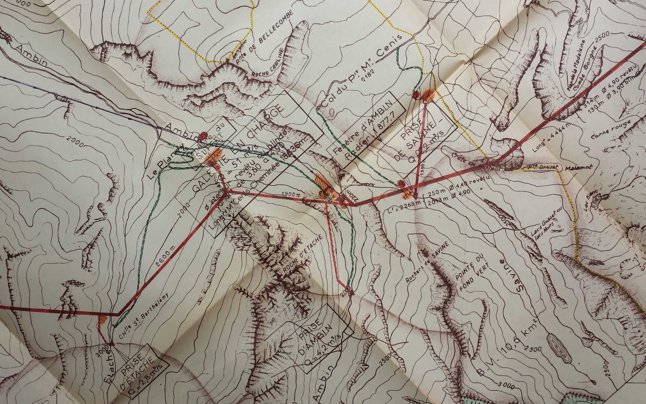
Printed map of shielded and pressurized underground culvert carrying water from the Mont Cenis Lake to the power hose in Villarodin. Diameters, flow rates and lengths are visible.
François Lacombe www.infos-reseaux.com
Licensing
![]()
![]()
![]()
This work is licensed under the Creative Commons Attribution-ShareAlike 3.0 License.
Attribution: François Lacombe - www.infos-reseaux.com
Attribution: François Lacombe - www.infos-reseaux.com
but see https://wiki.openstreetmap.org/wiki/User_talk:Fanfouer#Map_license
File history
Click on a date/time to view the file as it appeared at that time.
| Date/Time | Thumbnail | Dimensions | User | Comment | |
|---|---|---|---|---|---|
| current | 00:04, 1 November 2017 | | 2,183 × 1,364 (2.18 MB) | Fanfouer (talk | contribs) | Printed map of shielded and pressurized underground culvert carrying water to a hydro power plant. Diameters, flow rates and lengths are visible. François Lacombe www.infos-reseaux.com |
You cannot overwrite this file.
File usage
The following 10 pages use this file: