File:I-405 at CA 19.jpg
Jump to navigation
Jump to search

Size of this preview: 800 × 543 pixels. Other resolutions: 320 × 217 pixels | 640 × 434 pixels | 896 × 608 pixels.
Original file (896 × 608 pixels, file size: 177 KB, MIME type: image/jpeg)
This file and its description are from Wikimedia Commons.
This image is in the public domain in the United States because it only contains materials that originally came from the United States Geological Survey, an agency of the United States Department of the Interior. For more information, see the official USGS copyright policy.
|
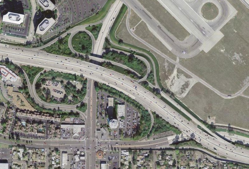
An aerial photo from March 29, 2004 of the w:Interstate 405/w:California State Highway 19 interchange near w:Los Angeles, California, a modified w:cloverleaf interchange.
33°48′21″N 118°08′31″W / 33.80595°N 118.142048°W
| Object location | | View this and other nearby images on: OpenStreetMap |
|---|
File history
Click on a date/time to view the file as it appeared at that time.
| Date/Time | Thumbnail | Dimensions | User | Comment | |
|---|---|---|---|---|---|
| current | 03:16, 10 January 2005 | | 896 × 608 (177 KB) | wikimediacommons>SPUI~commonswiki | {{PD-USGov-Interior-USGS}}An aerial photo from March 29, 2004 of the Interstate 405/California State Highway 19 interchange near Los Angeles, California, a modified cloverleaf interchange. |
File usage
The following 3 pages use this file: