File:ITO Map - Schools.png
Jump to navigation
Jump to search
Size of this preview: 798 × 152 pixels. Other resolution: 1,123 × 214 pixels.
Original file (1,123 × 214 pixels, file size: 398 KB, MIME type: image/png)
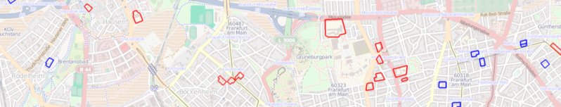
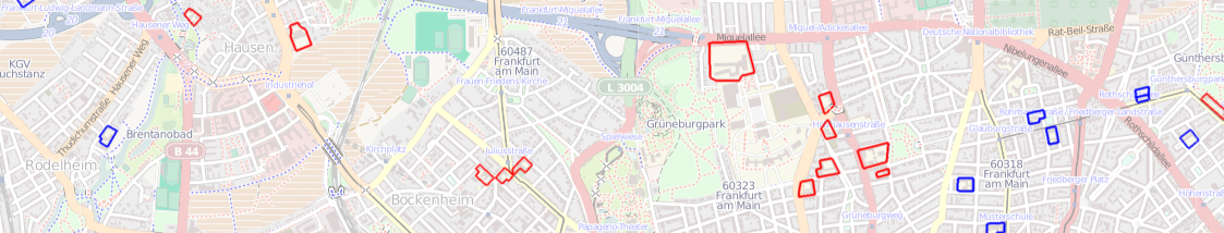
ITO Map overlay showing schools in Frankfurt, shown in blue if they are named and red if they are not named.
File history
Click on a date/time to view the file as it appeared at that time.
| Date/Time | Thumbnail | Dimensions | User | Comment | |
|---|---|---|---|---|---|
| current | 21:33, 3 March 2011 | 1,123 × 214 (398 KB) | PeterIto (talk | contribs) | ITO Map overlay showing schools in Frankfurt, shown in blue if they are named and red if they are not named. |
You cannot overwrite this file.
File usage
The following 3 pages use this file: