File:Indonesia president InaSAFE AusAID demo.jpg
Jump to navigation
Jump to search


Size of this preview: 800 × 533 pixels. Other resolutions: 320 × 213 pixels | 640 × 427 pixels | 960 × 640 pixels.
Original file (960 × 640 pixels, file size: 86 KB, MIME type: image/jpeg)
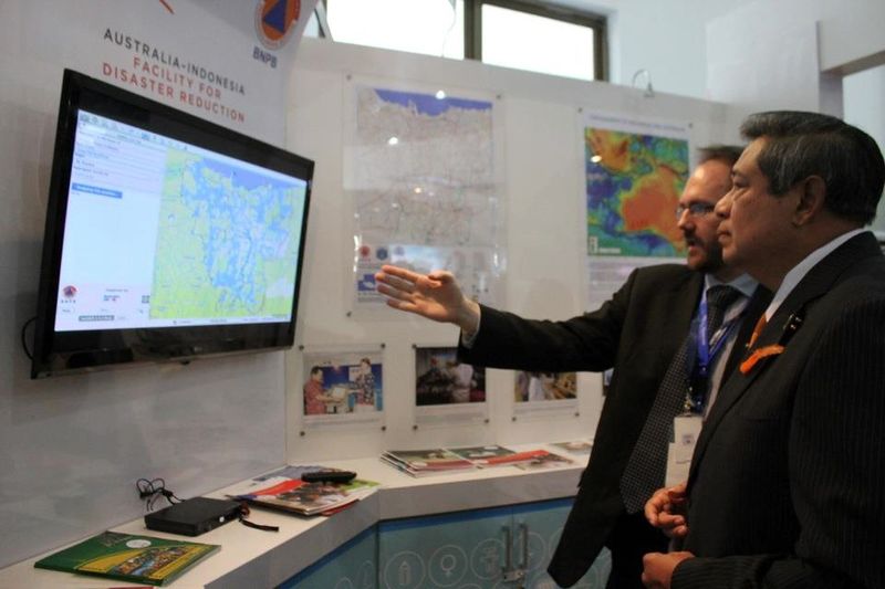
Trevor Dhu from AusAID demonstrates flood impact in Jakarta with InaSAFE to President Susilo Bambang Yudhoyono at the 5th Asian Ministerial Conference on Disaster Risk Reduction . One of the key sets of information used in the analysis is OpenStreetMap data
Originally taken by Clare Price from AusAID and released here under a CC-BY license
This is a Featured image, which means that it has been identified as one of the best examples of OpenStreetMap mapping, or that it provides a useful illustration of the OpenStreetMap project. If you know another image of similar quality, you can nominate it on Featured image proposals.
Front-page image for week 45 of 2012 (5–11 Nov.).
- Image descriptions
- Deutsch : Trevor Dhu von AusAID zeigte dem Präsidenten Susilo Bambang Yudhoyono auf dem 5. Asiatischen Ministerkonferenz für Katastrophenschutz das Hochwasser in Jakarta mit InaSAFE. Ein Teil der wichtigsten Informationen für die Analyse basieren auf OSM-Daten.
- English : Trevor Dhu from AusAID demonstrates flood impact in Jakarta with InaSAFE to President Susilo Bambang Yudhoyono at the 5th Asian Ministerial Conference on Disaster Risk Reduction . One of the key sets of information used in the analysis is OpenStreetMap data
- français : Trevor Dhu de l'AusAID fait la démonstration l'impacte d'une inondation à Jakarta à l'aide de InaSAFE au président Susilo Bambang Yudhoyono, à la 5e conférence interministérielle asiatique sur la réduction des risques de désastre. Un des ensemble d'information principaux utilisé dans cette analyse est constitué des données d'OpenStreetMap.
- italiano : Trevor Dhu di AusAID mostra con InaSAFE l'impatto delle inondazioni a Giakarta al Presidente Susilo Bambang Yudhoyono, durante la 5ª Conferenza Ministeriale Asiatica sulla Riduzione dei Rischi da Disastro. Uno dei principali insiemi di informazioni utilizzati nell'analisi proviene da OpenStreetMap.
- 中文(简体) : AusAID 的 Trevor Dhu,使用 InaSAFE 工具的协助下,在第五届减低灾害潜势亚洲部长级会议,向总统 Susilo Bambang Yudhoyono 展示雅加达淹水的影响。其中采用的重要资讯之一是开放街图资料。
- 中文(繁體) : AusAID 的 Trevor Dhu,使用 InaSAFE 工具的協助下,在第五屆減低災害潛勢亞洲部長級會議,向總統 Susilo Bambang Yudhoyono 展示雅加達淹水的影響。其中採用的重要資訊之一是開放街圖資料。
File history
Click on a date/time to view the file as it appeared at that time.
| Date/Time | Thumbnail | Dimensions | User | Comment | |
|---|---|---|---|---|---|
| current | 14:12, 2 November 2012 | | 960 × 640 (86 KB) | Harry Wood (talk | contribs) | picture email to me by wonderchook for image of the week |
You cannot overwrite this file.
File usage
The following 6 pages use this file: