File:IrelandBingCoverage201011.png
Jump to navigation
Jump to search
Size of this preview: 480 × 599 pixels. Other resolutions: 192 × 240 pixels | 547 × 683 pixels.
Original file (547 × 683 pixels, file size: 145 KB, MIME type: image/png)
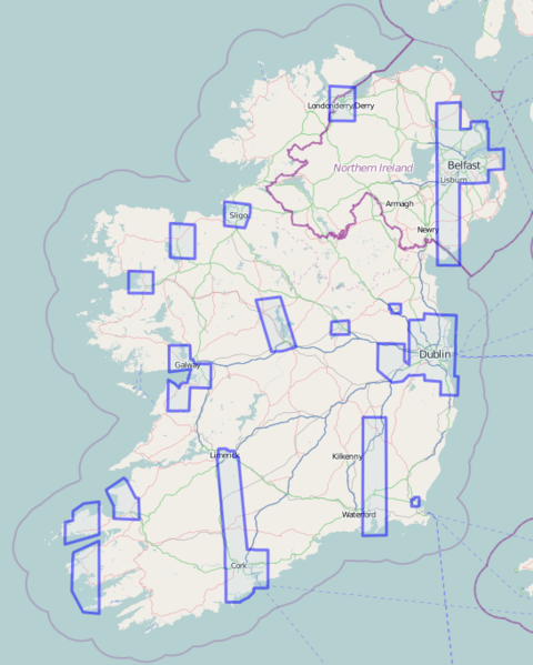
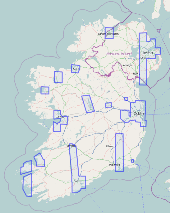
Map of Ireland showing Bing hi-resolution satellite imagery coverage
![]()
Contains map data © OpenStreetMap contributors, made available under the terms of the Creative Commons Attribution-ShareAlike 2.0 (CC-BY-SA-2.0).
File history
Click on a date/time to view the file as it appeared at that time.
| Date/Time | Thumbnail | Dimensions | User | Comment | |
|---|---|---|---|---|---|
| current | 17:25, 9 February 2011 | | 547 × 683 (145 KB) | IrlJidel (talk | contribs) | Add Waterville in Kerry |
| 18:35, 27 November 2010 | 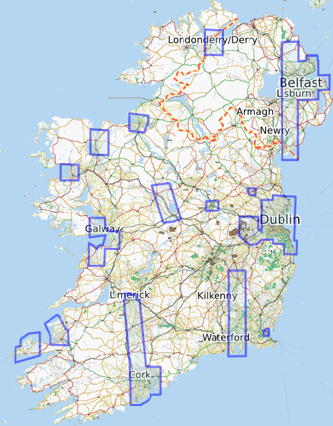 | 467 × 598 (463 KB) | IrlJidel (talk | contribs) | Map of Ireland showing Bing hi-resolution satellite imagery coverage |
You cannot overwrite this file.
File usage
There are no pages that use this file.