File:Itv lewis oxford.jpg
Jump to navigation
Jump to search


Size of this preview: 800 × 500 pixels. Other resolutions: 320 × 200 pixels | 640 × 400 pixels | 1,024 × 640 pixels | 1,280 × 800 pixels.
Original file (1,280 × 800 pixels, file size: 130 KB, MIME type: image/jpeg)
http://lists.openstreetmap.org/pipermail/talk-gb/2012-May/013268.html
This is a Featured image, which means that it has been identified as one of the best examples of OpenStreetMap mapping, or that it provides a useful illustration of the OpenStreetMap project. If you know another image of similar quality, you can nominate it on Featured image proposals.
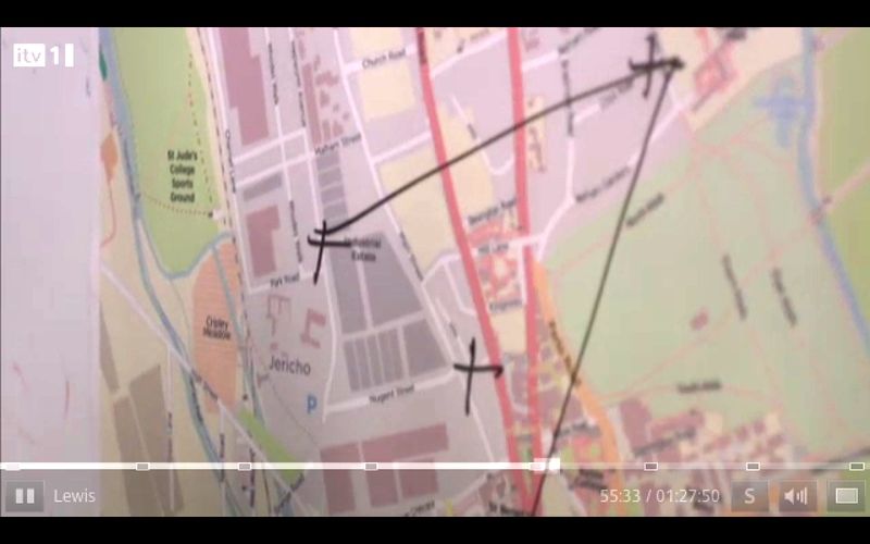
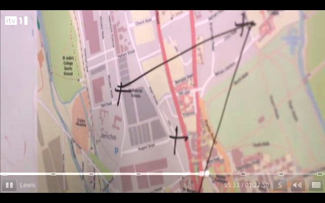
Front-page image for week 22 of 2012 (28 May – 3 Jun.).
- Image descriptions
- Deutsch : Mithilfe von OpenStreetMap kann man ganz einfach fiktionale Karten erstellen, wie beispielsweise Inspector Lewis' (speziell für die Serie) bearbeitete Version von Oxford(in Minute 55).
- English : OpenStreetMap's technology makes it easy to create fictional maps, for example Inspector Lewis' version of Oxford (at minute 55), modified to include plot-specific details
- español : La tecnología de OpenStreetMap hace sencillo crear mapas ficticios, por ejemplo la versión del Inspector Lewis sobre Oxford (en el minuto 55), modificada para incluir detalles específicos sobre el plano.
- français : La technologie d’OpenStreetMap permet de créer facilement des cartes fictives, comme par exemple pour la version d’Oxford de l’inspecteur Lewis (à la minute 55), modifiée pour inclure des détails de l’intrigue.
- italiano : La tecnologia OpenStreetMap rende facile la creazione di mappe di fantasia, ad esempio la versione di Oxford dell'Ispettore Lewis (al minuto 55), modificata per includere dettagli specifici della trama
- 中文(简体) : 开放街图的技术让人很容易产生虚构的地图,例如 Inspector Lewis' 版本的牛津 (55 分处),地图被改成,包括跟剧情相关的细节
- 中文(繁體) : 開放街圖的技術讓人很容易產生虛構的地圖,例如 Inspector Lewis' 版本的牛津 (55 分處),地圖被改成,包括跟劇情相關的細節
File history
Click on a date/time to view the file as it appeared at that time.
| Date/Time | Thumbnail | Dimensions | User | Comment | |
|---|---|---|---|---|---|
| current | 16:57, 28 May 2012 | | 1,280 × 800 (130 KB) | Harry Wood (talk | contribs) | bit more brightness |
| 19:55, 27 May 2012 | 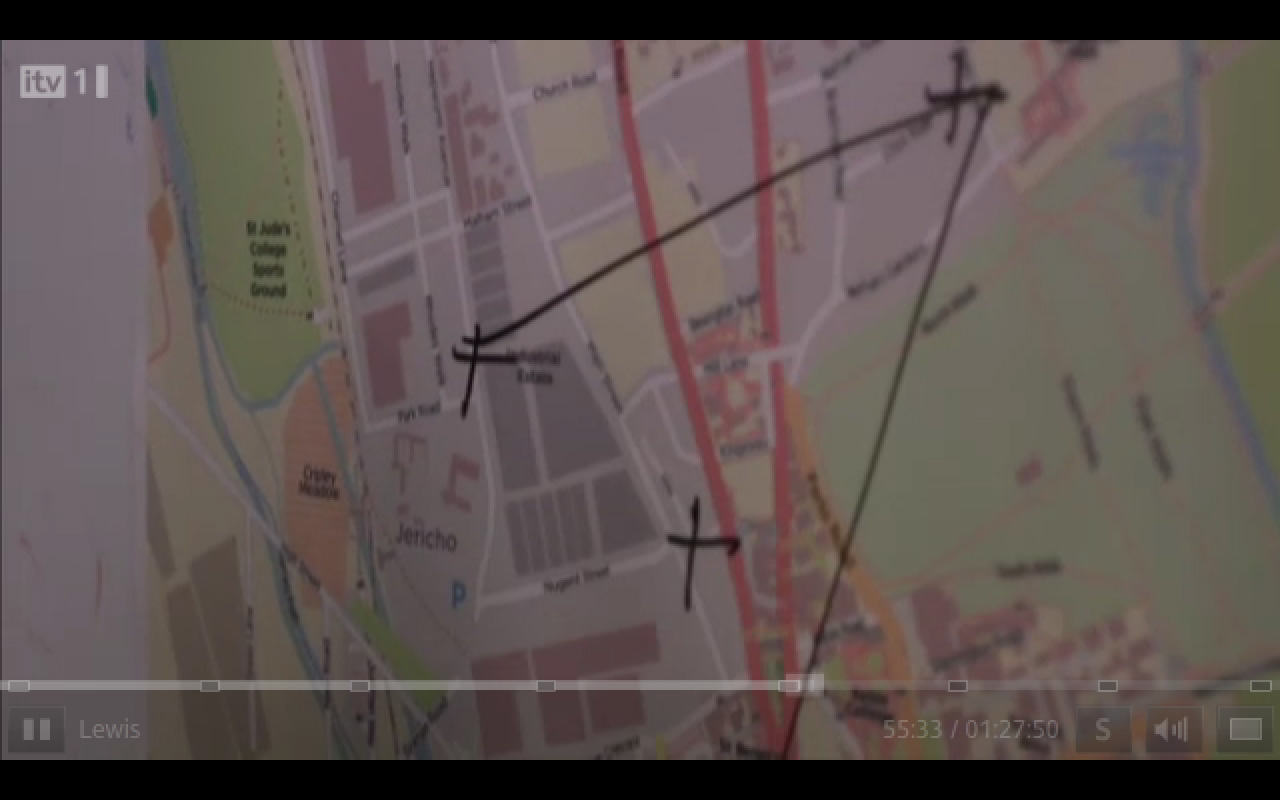 | 1,280 × 800 (133 KB) | Ojw (talk | contribs) | http://lists.openstreetmap.org/pipermail/talk-gb/2012-May/013268.html |
You cannot overwrite this file.
File usage
The following 6 pages use this file: