File:Josm-konstruktion-1.png
Jump to navigation
Jump to search


Size of this preview: 766 × 600 pixels. Other resolutions: 307 × 240 pixels | 613 × 480 pixels | 871 × 682 pixels.
Original file (871 × 682 pixels, file size: 102 KB, MIME type: image/png)
Summary
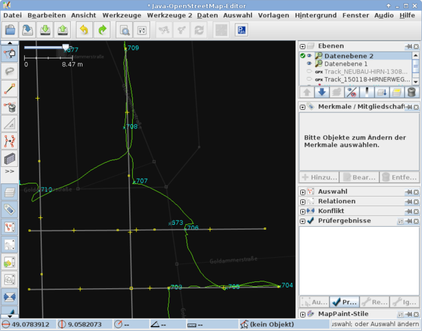
drawing a building out of GPS (Garmin) measurements. See https://www.openstreetmap.org/user/Nakaner/diary/34312 for more description
Licensing
![]()
This file is a JOSM screenshot, without imagery in a background.
![]()
"JOSM" (Java OpenStreetMap Editor – josm.openstreetmap.de) is free software released under the terms of the GNU General Public License as published by the Free Software Foundation; either version 2 of the license, or any later version.
File history
Click on a date/time to view the file as it appeared at that time.
| Date/Time | Thumbnail | Dimensions | User | Comment | |
|---|---|---|---|---|---|
| current | 22:56, 1 February 2015 | | 871 × 682 (102 KB) | Nakaner (talk | contribs) | drawing a building out of GPS (Garmin) measurments Category:JOSM Category:Buildings |
You cannot overwrite this file.
File usage
There are no pages that use this file.