File:Juli 2022- Die 1000-km-Marke ist geknackt!.png
Jump to navigation
Jump to search

Size of this preview: 600 × 600 pixels. Other resolutions: 240 × 240 pixels | 480 × 480 pixels | 768 × 768 pixels | 1,080 × 1,080 pixels.
Original file (1,080 × 1,080 pixels, file size: 1.36 MB, MIME type: image/png)
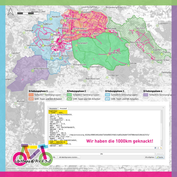
Im Juli 2022 konnten wir auf Instagram (@lgmaps) vermelden, dass im Landkreis Lüneburg seit 2019 nun auf über 1000 km Streckenlänge fahrradrelevante Daten in der OSM hinterlegt sind!
![]()
![]()
![]()
This work is licensed under the Creative Commons Attribution-ShareAlike 4.0 License.
Attribution: Antje Seidel, LGMaps
Attribution: Antje Seidel, LGMaps
| Contains map data © OpenStreetMap contributors, made available under the terms of the Open Database License (ODbL).
The ODbL does not require any particular license for maps produced from ODbL data, produced maps may be subject also to other licences. |
File history
Click on a date/time to view the file as it appeared at that time.
| Date/Time | Thumbnail | Dimensions | User | Comment | |
|---|---|---|---|---|---|
| current | 10:17, 17 August 2022 | | 1,080 × 1,080 (1.36 MB) | Aseidel (talk | contribs) |
You cannot overwrite this file.
File usage
The following page uses this file: