File:KT13 Area.4.png
Jump to navigation
Jump to search

Size of this preview: 640 × 599 pixels. Other resolutions: 256 × 240 pixels | 774 × 725 pixels.
Original file (774 × 725 pixels, file size: 289 KB, MIME type: image/png)
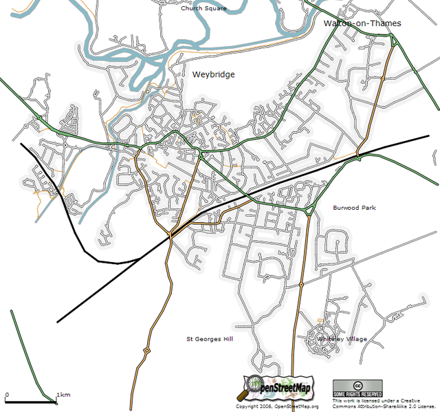
The Weybridge area as at 19 March 2006. Featuring canals, rivers, railways and residential shading (and a few more roads).
This map image is currently in use on the wikipedia:Weybridge article.
![]()
Contains map data © OpenStreetMap contributors, made available under the terms of the Creative Commons Attribution-ShareAlike 2.0 (CC-BY-SA-2.0).
File history
Click on a date/time to view the file as it appeared at that time.
| Date/Time | Thumbnail | Dimensions | User | Comment | |
|---|---|---|---|---|---|
| current | 09:11, 20 March 2006 | | 774 × 725 (289 KB) | 80n (talk | contribs) | |
| 08:53, 20 March 2006 | 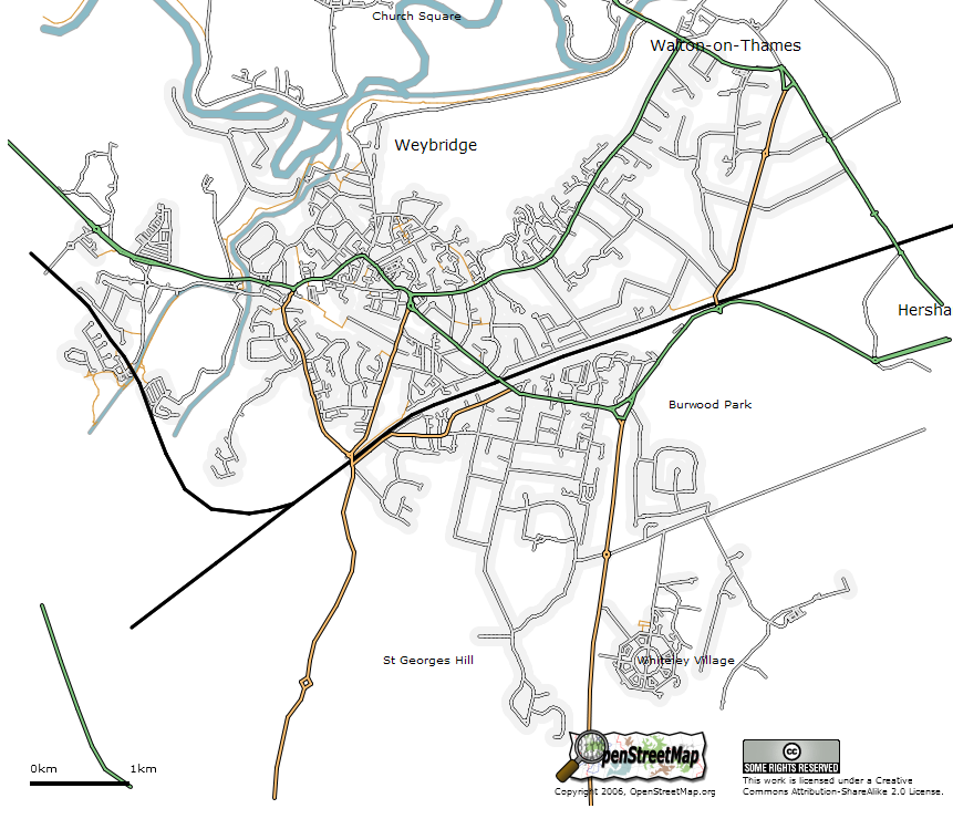 | 861 × 740 (298 KB) | 80n (talk | contribs) | ||
| 00:22, 20 March 2006 |  | 693 × 679 (258 KB) | 80n (talk | contribs) | The Weybridge area as at 19 March 2006. Featuring canals, rivers, railways and residential shading (and a few more roads). |
You cannot overwrite this file.
File usage
The following file is a duplicate of this file (more details):
- File:KT13 Area.4.png from Wikimedia Commons
The following 6 pages use this file: