File:Kangaroo Valley rough area.png
Jump to navigation
Jump to search


Size of this preview: 800 × 525 pixels. Other resolutions: 320 × 210 pixels | 640 × 420 pixels | 1,024 × 672 pixels | 1,302 × 854 pixels.
Original file (1,302 × 854 pixels, file size: 1.27 MB, MIME type: image/png)
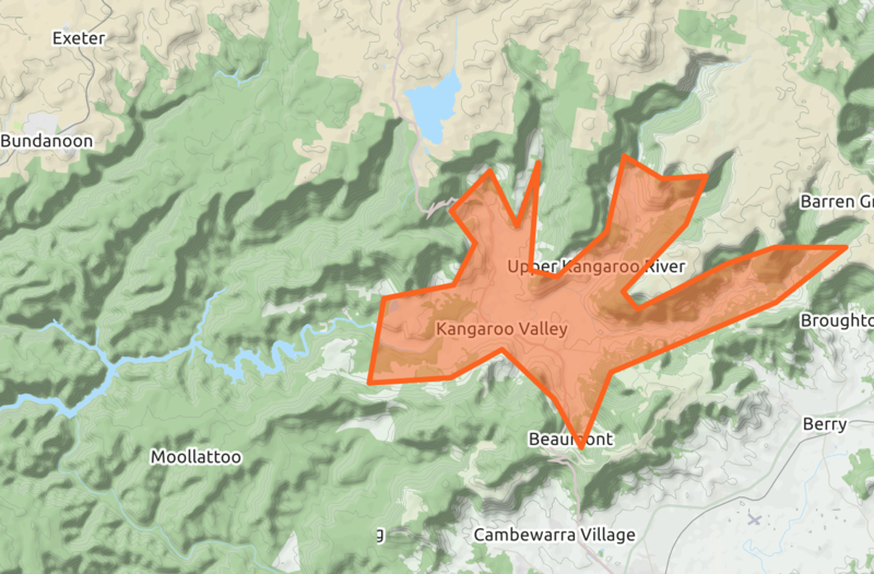
The first version of way 889441949 “Kangaroo Valley” which shows why mapping these areas is rarely verfiable - see https://www.openstreetmap.org/way/889441949/history#map=11/-34.7631/150.5185&layers=C
File history
Click on a date/time to view the file as it appeared at that time.
| Date/Time | Thumbnail | Dimensions | User | Comment | |
|---|---|---|---|---|---|
| current | 07:45, 29 December 2020 | | 1,302 × 854 (1.27 MB) | Jeisenbe (talk | contribs) |
You cannot overwrite this file.
File usage
The following page uses this file: