File:Karte ThWald.pdf
Jump to navigation
Jump to search

Size of this JPG preview of this PDF file: 424 × 600 pixels. Other resolutions: 170 × 240 pixels | 339 × 480 pixels | 543 × 768 pixels | 724 × 1,024 pixels | 1,754 × 2,481 pixels.
Original file (1,754 × 2,481 pixels, file size: 983 KB, MIME type: application/pdf)
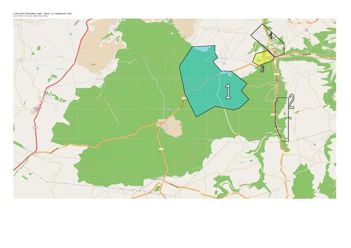
OSM Karte mit den mapping-areas zum DGFK-Event am 18.10.2008 in Tharandt
File history
Click on a date/time to view the file as it appeared at that time.
| Date/Time | Thumbnail | Dimensions | User | Comment | |
|---|---|---|---|---|---|
| current | 20:17, 16 September 2008 |  | 1,754 × 2,481 (983 KB) | ThomasKlosa (talk | contribs) | OSM Karte mit den mapping-areas zum DGFK-Event am 18.10.2008 in Tharandt |
You cannot overwrite this file.
File usage
There are no pages that use this file.