File:KartverketLaserScanJOSM.png
Jump to navigation
Jump to search

Size of this preview: 800 × 595 pixels. Other resolutions: 320 × 238 pixels | 640 × 476 pixels | 1,024 × 761 pixels | 1,280 × 952 pixels | 2,642 × 1,964 pixels.
Original file (2,642 × 1,964 pixels, file size: 6.92 MB, MIME type: image/png)
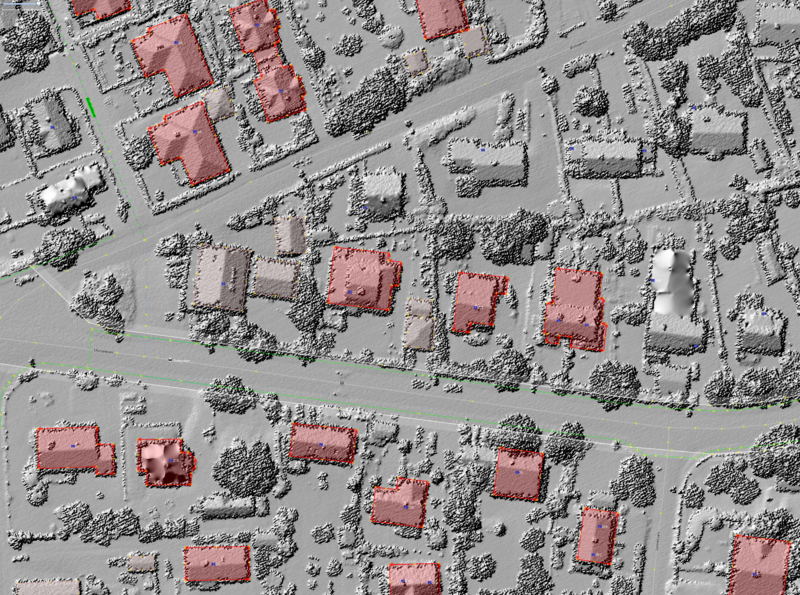
A screen-shot of JOSM using Kartverkets 10pkt laser imagery to draw buildings
Licensing
![]()
This file is a screenshot of the software JOSM, with imagery in background. It may include OpenStreetMap data, in such case ODbL license also applies.
![]()
"JOSM" (Java OpenStreetMap Editor – josm.openstreetmap.de) is free software released under the terms of the GNU General Public License as published by the Free Software Foundation; either version 2 of the license, or any later version.
License of imagery not specified! [→ template]
| Contains map data © OpenStreetMap contributors, made available under the terms of the Open Database License (ODbL).
The ODbL does not require any particular license for maps produced from ODbL data, produced maps may be subject also to other licences. |
File history
Click on a date/time to view the file as it appeared at that time.
| Date/Time | Thumbnail | Dimensions | User | Comment | |
|---|---|---|---|---|---|
| current | 16:08, 8 April 2018 | | 2,642 × 1,964 (6.92 MB) | FredrikLindseth (talk | contribs) |
You cannot overwrite this file.
File usage
The following page uses this file: