File:Khorog after.png
Jump to navigation
Jump to search


Size of this preview: 800 × 498 pixels. Other resolutions: 320 × 199 pixels | 640 × 399 pixels | 1,095 × 682 pixels.
Original file (1,095 × 682 pixels, file size: 238 KB, MIME type: image/png)
Summary
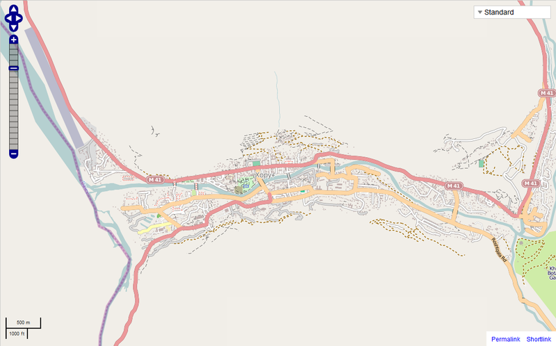
How the town of Khorog was mapped on OSM on August 2nd, 2012
Licensing
![]()
![]()
![]()
This screenshot contains OpenStreetMap Carto rendering.
The OpenStreetMap Carto map style is made available under the Creative Commons CC-0 1.0 Universal Public Domain Dedication.
- Attribution to the map data:
![]()
Contains map data © OpenStreetMap contributors, made available under the terms of the Creative Commons Attribution-ShareAlike 2.0 (CC-BY-SA-2.0).
File history
Click on a date/time to view the file as it appeared at that time.
| Date/Time | Thumbnail | Dimensions | User | Comment | |
|---|---|---|---|---|---|
| current | 16:36, 2 August 2012 | | 1,095 × 682 (238 KB) | Shenriod (talk | contribs) | |
| 16:35, 2 August 2012 | 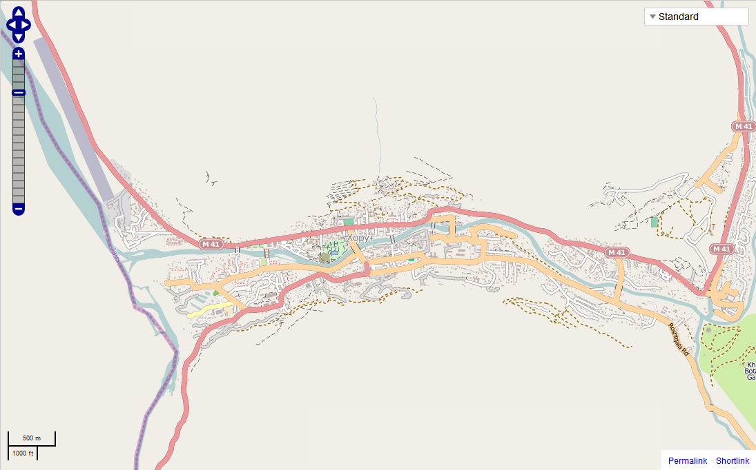 | 1,095 × 682 (238 KB) | Shenriod (talk | contribs) | ||
| 16:31, 2 August 2012 | 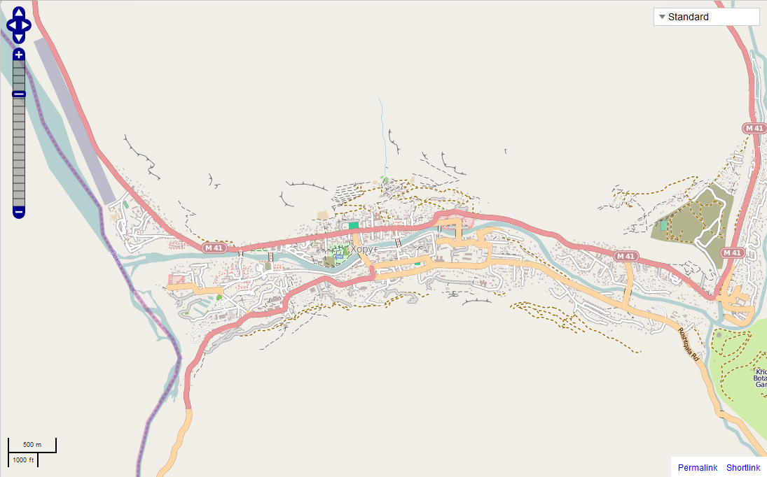 | 1,095 × 682 (251 KB) | Shenriod (talk | contribs) | ||
| 12:57, 2 August 2012 |  | 1,412 × 821 (229 KB) | Shenriod (talk | contribs) | How the town of Khorog was mapped on OSM on August 2nd, 2012 |
You cannot overwrite this file.
File usage
The following page uses this file: