File:Kt16 chertsey 20060505.png
Jump to navigation
Jump to search

Size of this preview: 793 × 600 pixels. Other resolutions: 318 × 240 pixels | 635 × 480 pixels | 1,016 × 768 pixels | 1,058 × 800 pixels.
Original file (1,058 × 800 pixels, file size: 394 KB, MIME type: image/png)
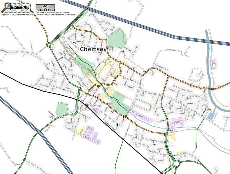
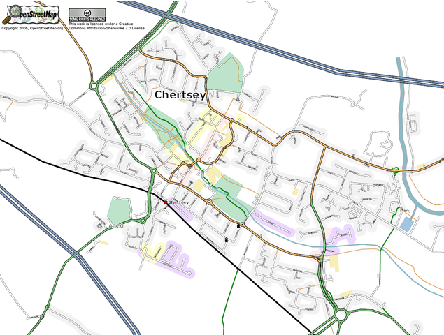
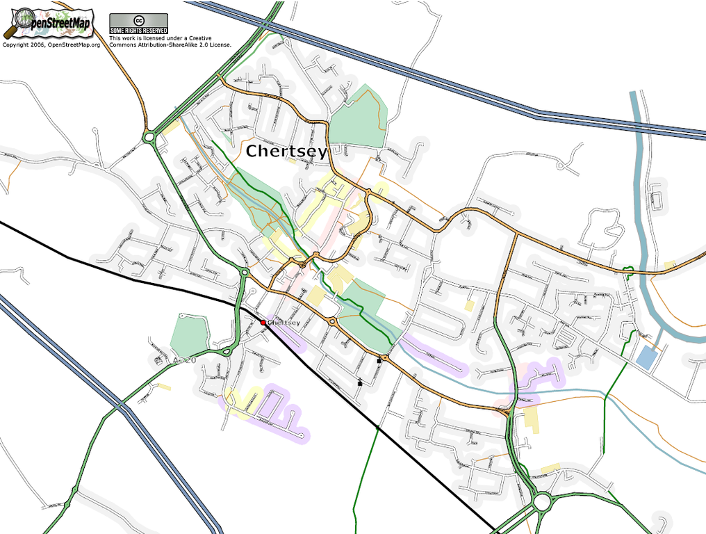
Post code area KT16, Chertsey as at May 5, 2006
![]()
Contains map data © OpenStreetMap contributors, made available under the terms of the Creative Commons Attribution-ShareAlike 2.0 (CC-BY-SA-2.0).
File history
Click on a date/time to view the file as it appeared at that time.
| Date/Time | Thumbnail | Dimensions | User | Comment | |
|---|---|---|---|---|---|
| current | 08:28, 5 May 2006 | | 1,058 × 800 (394 KB) | 80n (talk | contribs) | Post code area KT16, Chertsey as at May 5, 2006 |
You cannot overwrite this file.
File usage
The following 2 pages use this file: