File:La-paz.pdf
Jump to navigation
Jump to search

Size of this JPG preview of this PDF file: 800 × 566 pixels. Other resolutions: 320 × 226 pixels | 640 × 452 pixels | 1,024 × 724 pixels | 1,280 × 905 pixels | 2,481 × 1,754 pixels.
Original file (2,481 × 1,754 pixels, file size: 1.44 MB, MIME type: application/pdf)
Summary
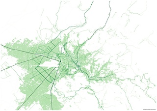
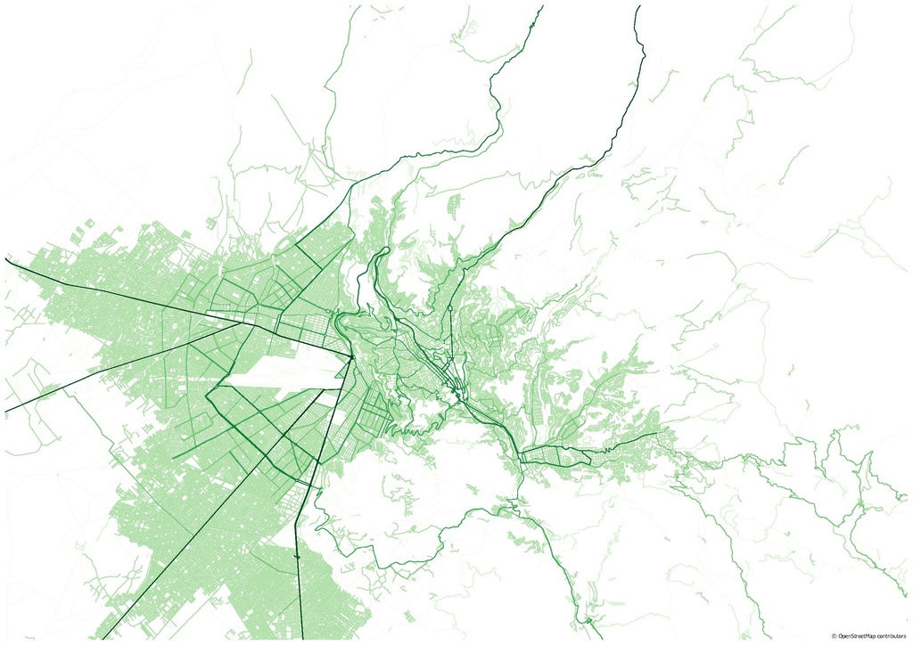
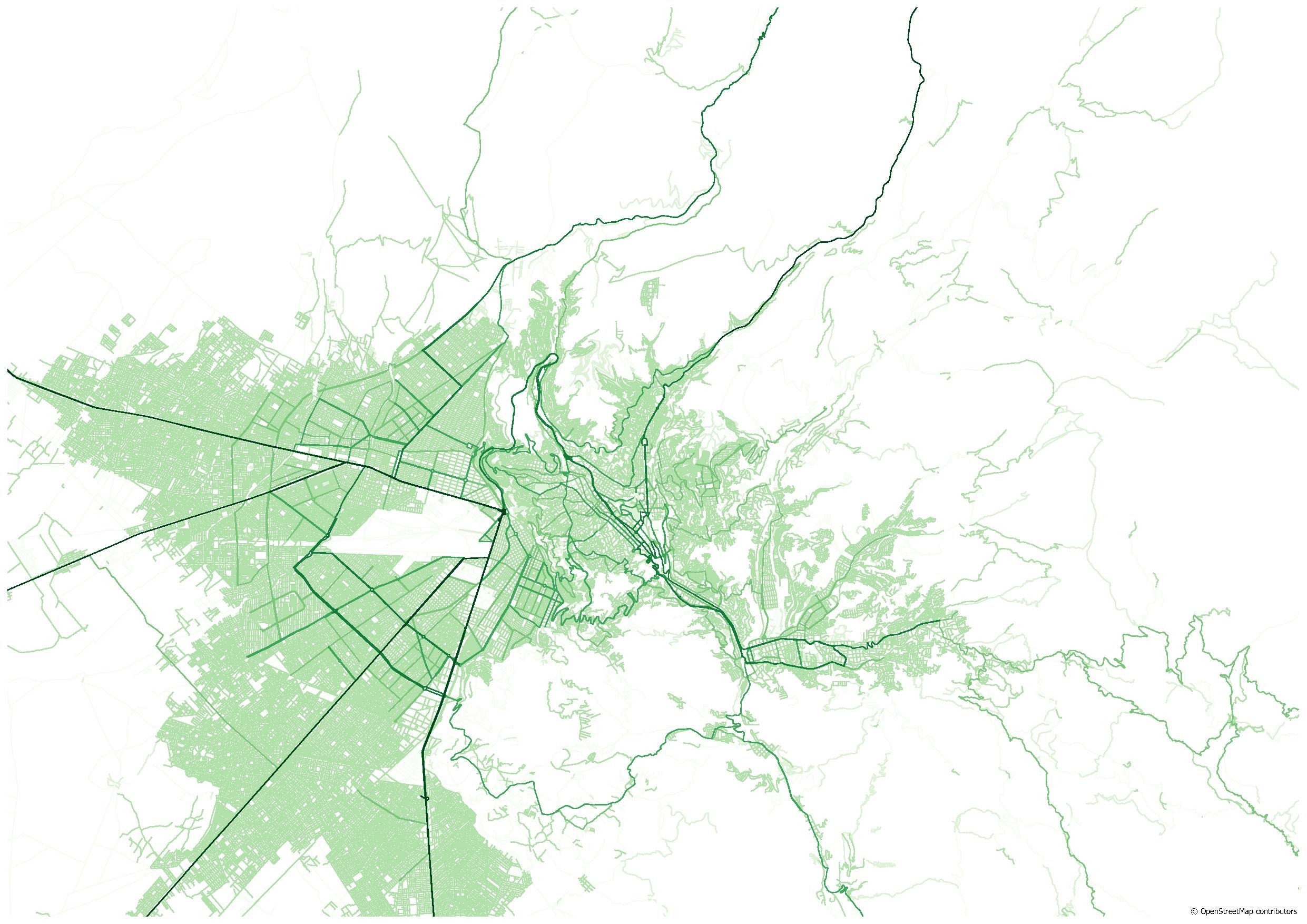
Map of La Paz created for the State of the Map 2019 social event by Adam Rousell and Sabrina Marx using OpenStreetMap data and QGIS.
Licensing
![]()
![]()
![]()
This work is licensed under the Creative Commons Attribution-ShareAlike 4.0 License.
Attribution not specified as a parameter! THIS LICENSE ALWAYS REQUIRES ATTRIBUTION! Use {{CC-BY-SA-4.0|Attribution, typically name of author}} See Template:CC-BY-SA-4.0 for full description this template should be used.
Attribution not specified as a parameter! THIS LICENSE ALWAYS REQUIRES ATTRIBUTION! Use {{CC-BY-SA-4.0|Attribution, typically name of author}} See Template:CC-BY-SA-4.0 for full description this template should be used.
File history
Click on a date/time to view the file as it appeared at that time.
| Date/Time | Thumbnail | Dimensions | User | Comment | |
|---|---|---|---|---|---|
| current | 15:42, 24 October 2019 |  | 2,481 × 1,754 (1.44 MB) | Tyr (talk | contribs) | Map created for the State of the Map 2019 [https://2019.stateofthemap.org/events/#main-social-dinner social event] by Adam Rousell and Sabrina Marx using OpenStreetMap data and QGIS. |
You cannot overwrite this file.
File usage
There are no pages that use this file.