File:Ladder on hiking path.jpg
Jump to navigation
Jump to search

Size of this preview: 800 × 538 pixels. Other resolutions: 320 × 215 pixels | 640 × 430 pixels | 1,024 × 688 pixels | 1,280 × 860 pixels | 1,594 × 1,071 pixels.
Original file (1,594 × 1,071 pixels, file size: 451 KB, MIME type: image/jpeg)
Summary
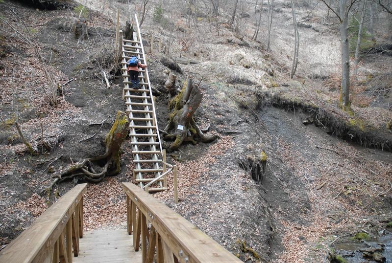
The Schluchtensteig (Gorge Trail) is a (quite) long distance hiking path running through the southern part of the Black Forest in southwest of Germany. The steig passes this ladder near the small town Blumberg. I suggest introducing a "highway=ladder" point feature, because a ladder in the way may render the way unusable for people hiking with dogs.
Licensing
![]()
This file has been released into the public domain by the copyright holder, its copyright has expired, or it is ineligible for copyright. This applies worldwide.
Please, please use more specific template such as {{PD-self}} / {{PD-creator}} / {{PD-shape}} / {{PD-USGov}} / {{PD-old}} / {{PD-RU-exempt}} ... This template is not making clear why this work is in the public domain.
Please, please use more specific template such as {{PD-self}} / {{PD-creator}} / {{PD-shape}} / {{PD-USGov}} / {{PD-old}} / {{PD-RU-exempt}} ... This template is not making clear why this work is in the public domain.
File history
Click on a date/time to view the file as it appeared at that time.
| Date/Time | Thumbnail | Dimensions | User | Comment | |
|---|---|---|---|---|---|
| current | 15:22, 12 February 2012 | | 1,594 × 1,071 (451 KB) | Netzwolf (talk | contribs) | The Schluchtensteig (Gorge Trail) is a (quite) long distance hiking path running through the southern part of the Black Forest in southwest of Germany. The steig passes this ladder near the small town Blumberg. I suggest introducing a "highway=ladder" poi |
You cannot overwrite this file.
File usage
There are no pages that use this file.