File:Landsat7-Sentinel2.png
Jump to navigation
Jump to search


No higher resolution available.
Landsat7-Sentinel2.png (684 × 506 pixels, file size: 555 KB, MIME type: image/png)
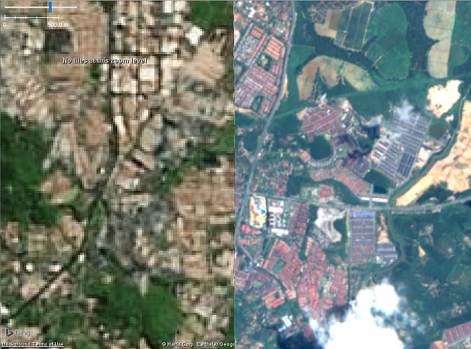
A screenshot from JOSM showing comparison between the low-resolution Landsat 7 from Bing imagery on the left and my self made Sentinel 2 imagery composite on the right.
Contains Copernicus Sentinel data 2016.
![]()
![]()
This image is composed entirely, or almost entirely, of Bing aerial imagery.
Bing imagery is not open licensed, but is generously made available to the OpenStreetMap project for deriving open licensed map data in editors such as JOSM, iD or Vespucci. This upload is not covered by permission described at Bing Maps, as OSM Wiki cannot be interpreted as "editor application" and "We require you use access credentials to use the service and require use of transaction tracking and/or session tracking methods for all uses of the service" is not fulfilled.
This image is a relatively minor extract of the (worldwide) Bing imagery, used for illustrative purposes on the OpenStreetMap wiki, to help document ways of using and interpreting the imagery in the OpenStreetMap mapping process.
This image is a relatively minor extract of the (worldwide) Bing imagery, used for illustrative purposes on the OpenStreetMap wiki, to help document ways of using and interpreting the imagery in the OpenStreetMap mapping process.
File history
Click on a date/time to view the file as it appeared at that time.
| Date/Time | Thumbnail | Dimensions | User | Comment | |
|---|---|---|---|---|---|
| current | 05:18, 27 February 2017 | | 684 × 506 (555 KB) | AkuAnakTimur (talk | contribs) | |
| 08:29, 5 February 2017 | 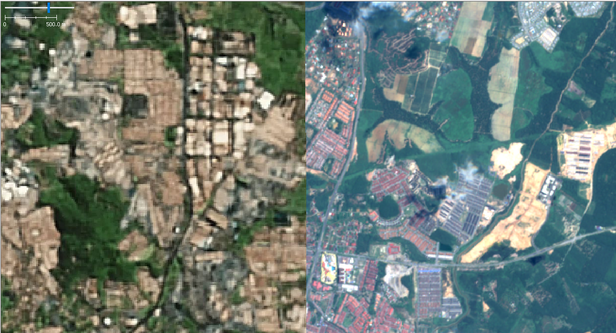 | 1,245 × 673 (891 KB) | AkuAnakTimur (talk | contribs) | A comparison between the low-resolution Landsat 7 from Mapbox satellite on the left and my self made Sentinel 2 imagery composite on the right. Contains Copernicus Sentinel data 2016 and Landsat 7 from Mapbox satellite. |
You cannot overwrite this file.
File usage
The following 2 pages use this file: