File:Landuse=farmyard.jpg
Landuse=farmyard.jpg (800 × 600 pixels, file size: 127 KB, MIME type: image/jpeg)
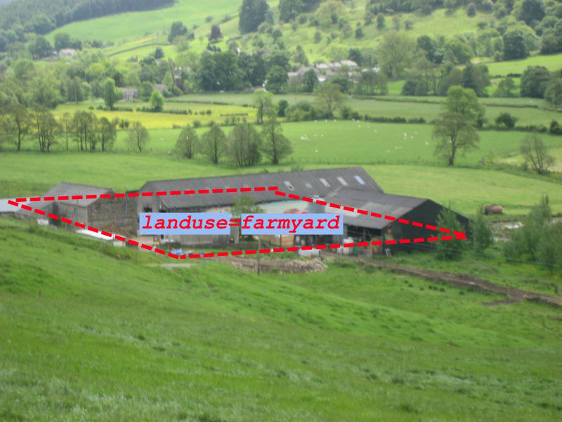
Illustration of Tag:landuse=farmyard.
By Harry Wood this photo was taken during the Pately Bridge Mapping Party. Beautiful Nidderdale!
The image File:Landuse=farmyard and landuse=farm.jpg was originally created (back in 2009) to show tagging of the surrounding farm fields, originally as landuse=farm, but....
There's so much endless discussion about the way to tag such fields, that it seemed useful to upload this image which stays out of that discussion. We can at least use this image on the landuse=farmyard documentation without controversy.
License
Photo by Harry Wood, and the tagging bits added on top also by Harry, also CC0.
![]()
![]()
The person who associated a work with this deed has dedicated the work to the public domain by waiving all of his or her rights to the work worldwide under copyright law, including all related and neighboring rights, to the extent allowed by law. You can copy, modify, distribute and perform the work, even for commercial purposes, all without asking permission.
File history
Click on a date/time to view the file as it appeared at that time.
| Date/Time | Thumbnail | Dimensions | User | Comment | |
|---|---|---|---|---|---|
| current | 09:35, 30 November 2021 | | 800 × 600 (127 KB) | Harry Wood (talk | contribs) | Illustration of landuse=farmyard as a modified version of my original File:Landuse=farmyard and landuse=farm.jpg |
You cannot overwrite this file.
File usage
The following 7 pages use this file: