File:Leaflet-OpenWeatherMap-Wind.png
Jump to navigation
Jump to search

Size of this preview: 683 × 600 pixels. Other resolutions: 273 × 240 pixels | 547 × 480 pixels | 875 × 768 pixels | 1,064 × 934 pixels.
Original file (1,064 × 934 pixels, file size: 1.5 MB, MIME type: image/png)
Summary
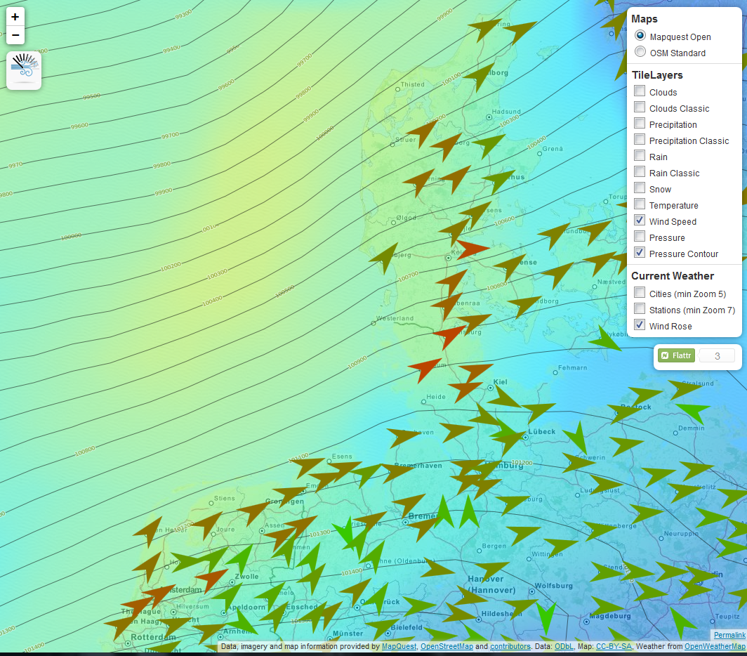
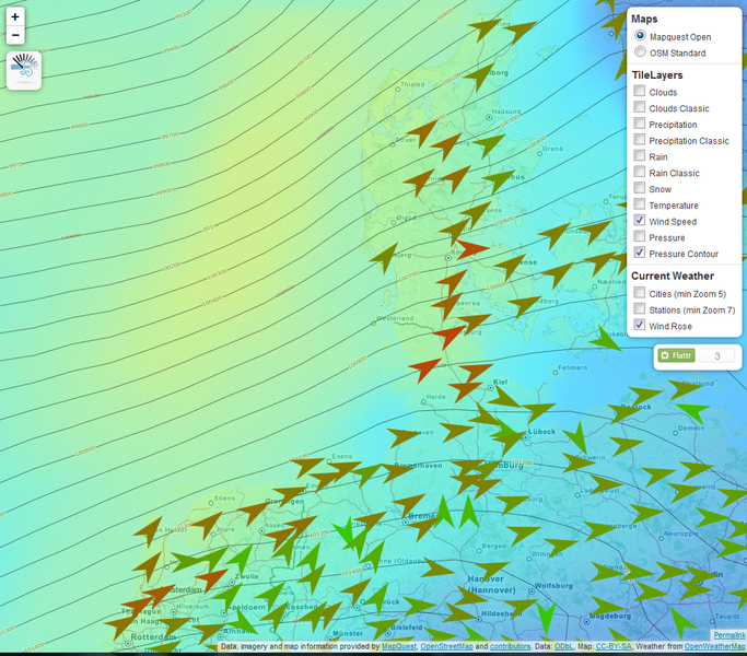
Arrows showing wind direction and color-coded wind speed. An example what can be done using the leaflet-openweathermap library from https://github.com/buche/leaflet-openweathermap
The image is CC-BY-SA because of the map background: Data, imagery and map information provided by MapQuest, OpenStreetMap and contributors. Data: ODbL, Map: CC-BY-SA, Weather from OpenWeatherMap
Licensing
![]()
![]()
![]()
This work is licensed under the Creative Commons Attribution-ShareAlike 2.0 License.
Attribution not specified as a parameter! THIS LICENSE ALWAYS REQUIRES ATTRIBUTION! Use {{CC-BY-SA-2.0|Attribution, typically name of author}} See Template:CC-BY-SA-2.0 for full description how this template should be used.
Note, there is
There is also
Attribution not specified as a parameter! THIS LICENSE ALWAYS REQUIRES ATTRIBUTION! Use {{CC-BY-SA-2.0|Attribution, typically name of author}} See Template:CC-BY-SA-2.0 for full description how this template should be used.
Note, there is
{{CC-BY-SA-2.0 OpenStreetMap}} for files based on old OSM map data, before the license change made on 2012-09-12.There is also
{{OSM Carto screenshot||old_license}} for files based on old OSM map data, before the license change made on 2012-09-12, created using OSM Carto map style.
- OpenWheatherMap data is "provided under the CC-BY-SA 2.0".
- Base map tiles: © MapQuest.
- Base map data: © OpenStreetMap contributors.
File history
Click on a date/time to view the file as it appeared at that time.
| Date/Time | Thumbnail | Dimensions | User | Comment | |
|---|---|---|---|---|---|
| current | 20:04, 18 April 2013 | | 1,064 × 934 (1.5 MB) | Zartbitter (talk | contribs) | Arrows showing wind direction and color-coded wind speed. An example what can be done using the leaflet-openweathermap library from https://github.com/buche/leaflet-openweathermap The image is CC-BY-SA because of the map background: Data, imagery and ... |
You cannot overwrite this file.
File usage
The following 2 pages use this file: