File:LocationNorthAmerica.png
Jump to navigation
Jump to search

Size of this preview: 800 × 407 pixels. Other resolutions: 320 × 163 pixels | 640 × 326 pixels | 1,024 × 521 pixels | 1,280 × 651 pixels | 2,759 × 1,404 pixels.
Original file (2,759 × 1,404 pixels, file size: 43 KB, MIME type: image/png)
This file and its description are from Wikimedia Commons.

|
File:Location of North America.svg is a vector version of this file. It should be used in place of this PNG file when not inferior.
File:LocationNorthAmerica.png → File:Location of North America.svg
For more information, see Help:SVG. |
 |
| Description |
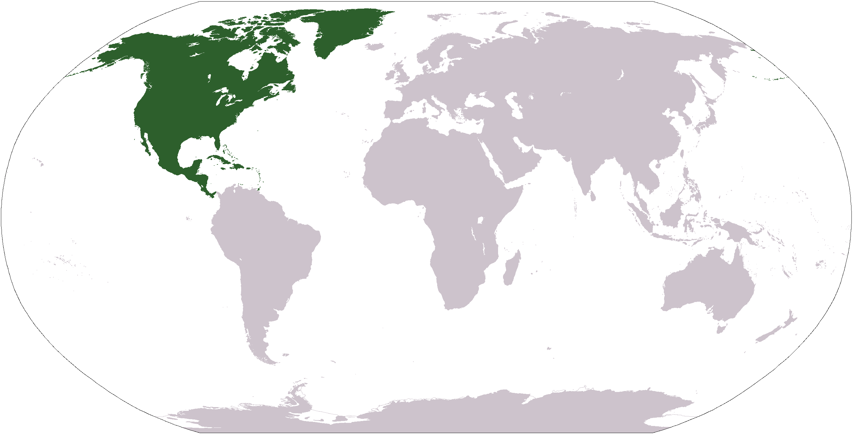
Deutsch: Weltkarte mit Fokus auf Nordamerika
English: World map depicting North America
Esperanto: Mondmapo bildiganta Nordamerikon
Español: Ubicación de América del Norte |
| Date | |
| Source | own work - map adapted from PDF world map at CIA World Fact Book |
| Author | Dado |
| Other versions |
Derivative works of this file: Wikinews Ameryka Północna mapa.png - |
This image is in the public domain because it contains materials that originally came from the United States Central Intelligence Agency's World Factbook.
|
 |
File history
Click on a date/time to view the file as it appeared at that time.
| Date/Time | Thumbnail | Dimensions | User | Comment | |
|---|---|---|---|---|---|
| current | 12:40, 19 January 2008 | | 2,759 × 1,404 (43 KB) | wikimediacommons>F l a n k e r | Transparency |
File usage
More than 100 pages use this file. The following list shows the first 100 pages that use this file only. A full list is available.
- Africa
- Antarctica
- Ar:إفريقيا
- Asia
- Az:Mapping projects
- Continents
- Earth
- Europe
- List of territory based projects
- North America
- Oceania
- South America
- Tr:List of territory based projects
- Tzm:ⵟⴰⴼⵔⵉⴽⵜ
- World
- User:Ashimema/Template4
- Template:Continent Browse
- Category:Africa
- Category:Africa/translations
- Category:Antarctica
- Category:Ar:Countries by continent
- Category:Ar:إفريقيا
- Category:Ar:بلد في إفريقيا
- Category:Asia
- Category:Cities in Africa
- Category:Cities in Asia
- Category:Cities in Europe
- Category:Cities in North America
- Category:Cities in Oceania
- Category:Cities in South America
- Category:Continents on Earth
- Category:Countries by continent
- Category:Countries by continent/translations
- Category:Countries in Africa
- Category:Countries in Africa/translations
- Category:Countries in Asia
- Category:Countries in Europe
- Category:Countries in North America
- Category:Countries in Oceania
- Category:Countries in South America
- Category:Data sources by continent
- Category:Data sources from Antarctica
- Category:Data sources from Europe
- Category:Data sources from North America
- Category:ES:África
- Category:Earth
- Category:Europe
- Category:FR:Afrique
- Category:FR:Pays en Afrique
- Category:FR:Pays par continent
- Category:Hamlets in Europe
- Category:Import by continent
- Category:Import from Africa
- Category:Import from Antarctica
- Category:Import from Asia
- Category:Import from Europe
- Category:Import from North America
- Category:Import from Oceania
- Category:Import from South America
- Category:Islands
- Category:Islands in Europe
- Category:Islands in North America
- Category:Islands in Oceania
- Category:Islands in South America
- Category:Maps of places in Africa
- Category:Maps of places in Asia
- Category:Maps of places in Europe
- Category:Maps of places in North America
- Category:Maps of places in Oceania
- Category:Maps of places in South America
- Category:Municipalities
- Category:Municipalities in Europe
- Category:North America
- Category:Oceania
- Category:Places in Europe
- Category:RU:Континенты на Земле
- Category:South America
- Category:State of the Map
- Category:State of the Map Europe
- Category:Towns in Asia
- Category:Towns in Europe
- Category:Towns in North America
- Category:Towns in South America
- Category:Tzm:ⵟⴰⴼⵔⵉⴽⵜ
- Category:Users in Africa
- Category:Users in Asia
- Category:Users in Europe
- Category:Users in North America
- Category:Users in Oceania
- Category:Users in South America
- Category:Villages in Africa
- Category:Villages in Asia
- Category:Villages in Europe
- Category:Villages in North America
- Category:Villages in Oceania
- Category:Villages in South America
- DE:Mapping projects
- DE:Welt
- FR:List of territory based projects
- RU:Азия
View more links to this file.