File:Lombardy Provinces.png
Jump to navigation
Jump to search
No higher resolution available.
Lombardy_Provinces.png (800 × 600 pixels, file size: 145 KB, MIME type: image/png)
This file and its description are from Wikimedia Commons.

|
File:Map of region of Lombardy, Italy, with provinces-en.svg is a vector version of this file. It should be used in place of this PNG file when not inferior.
File:Lombardy Provinces.png → File:Map of region of Lombardy, Italy, with provinces-en.svg
For more information, see Help:SVG. |
 |
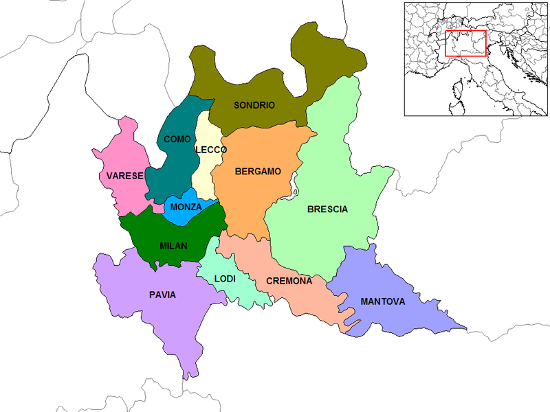
Map of the provinces of the Lombardy region of Italy. Created by Rarelibra for public domain use. Created using MapInfo Professional v7.5 and various mapping resources.
Other versions: File:Lombardy Provinces-el.png Ελληνικά
Author: Rarelibra
Link: http://en.wikipedia.org/wiki/Image:Lombardy_Provinces.png
| This work has been released into the public domain by its author, Rarelibra at English Wikipedia. This applies worldwide. In some countries this may not be legally possible; if so: Rarelibra grants anyone the right to use this work for any purpose, without any conditions, unless such conditions are required by law. |
File history
Click on a date/time to view the file as it appeared at that time.
| Date/Time | Thumbnail | Dimensions | User | Comment | |
|---|---|---|---|---|---|
| current | 08:22, 13 March 2010 | | 800 × 600 (145 KB) | wikimediacommons>Gigillo83 | Correzione confine MB |
File usage
The following page uses this file: