File:London cycle hire docking station, Denyer Street, Chelsea - geograph.org.uk - 2020872.jpg

Original file (4,000 × 3,000 pixels, file size: 2.88 MB, MIME type: image/jpeg)
Summary
| Description |
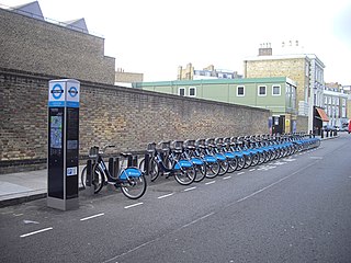
English: London cycle hire docking station, Denyer Street, Chelsea, near to Chelsea, Kensington And Chelsea, Great Britain.
Barclays Cycle Hire is a public bicycle sharing scheme that was launched on 30 July 2010 in London. At launch there were 315 bicycle docking stations and 5,000 bicycles available in central London, with 400 docking stations and 6,000 bicycles being available at the end of summer 2010. |
| Date | |
| Source | From geograph.org.uk; transferred by User:BaldBoris using geograph_org2commons. |
| Author | PAUL FARMER |
| Permission (Reusing this file) |
Creative Commons Attribution Share-alike license 2.0 |
| Attribution (required by the license) | PAUL FARMER / London cycle hire docking station, Denyer Street, Chelsea / |
| Camera location | | View this and other nearby images on: OpenStreetMap |
|---|
| Object location | | View this and other nearby images on: OpenStreetMap |
|---|
_region:GB-GBN_heading:22.00&language=en)
Licensing

|
This image was taken from the Geograph project collection. See this photograph's page on the Geograph website for the photographer's contact details. The copyright on this image is owned by PAUL FARMER and is licensed for reuse under the Creative Commons Attribution-ShareAlike 2.0 license.
|
- You are free:
- to share – to copy, distribute and transmit the work
- to remix – to adapt the work
- Under the following conditions:
- attribution – You must give appropriate credit, provide a link to the license, and indicate if changes were made. You may do so in any reasonable manner, but not in any way that suggests the licensor endorses you or your use.
- share alike – If you remix, transform, or build upon the material, you must distribute your contributions under the same or compatible license as the original.
File history
Click on a date/time to view the file as it appeared at that time.
| Date/Time | Thumbnail | Dimensions | User | Comment | |
|---|---|---|---|---|---|
| current | 00:59, 21 March 2011 | | 4,000 × 3,000 (2.88 MB) | wikimediacommons>File Upload Bot (Magnus Manske) |
File usage
The following 8 pages use this file: