File:LouisvilleKYExistingVSNewBuildings.png
Jump to navigation
Jump to search

Size of this preview: 664 × 599 pixels. Other resolutions: 266 × 240 pixels | 532 × 480 pixels | 851 × 768 pixels | 1,208 × 1,090 pixels.
Original file (1,208 × 1,090 pixels, file size: 675 KB, MIME type: image/png)
Summary
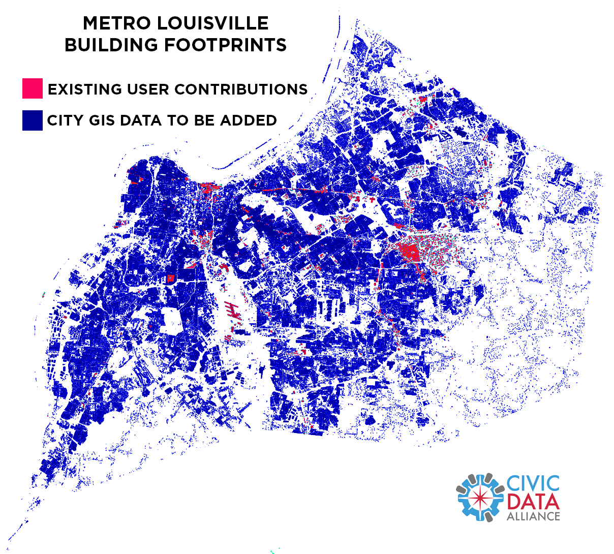
Map comparing existing OSM user contributions of building footprints in Louisville, KY vs official city gov's GIS data to be loaded.
Licensing
![]()
This file has been released into the public domain by the copyright holder, its copyright has expired, or it is ineligible for copyright. This applies worldwide.
Please, please use more specific template such as {{PD-self}} / {{PD-creator}} / {{PD-shape}} / {{PD-USGov}} / {{PD-old}} / {{PD-RU-exempt}} ... This template is not making clear why this work is in the public domain.
Please, please use more specific template such as {{PD-self}} / {{PD-creator}} / {{PD-shape}} / {{PD-USGov}} / {{PD-old}} / {{PD-RU-exempt}} ... This template is not making clear why this work is in the public domain.
File history
Click on a date/time to view the file as it appeared at that time.
| Date/Time | Thumbnail | Dimensions | User | Comment | |
|---|---|---|---|---|---|
| current | 18:58, 28 January 2015 | | 1,208 × 1,090 (675 KB) | Yourmapper (talk | contribs) | Map comparing existing OSM user contributions of building footprints in Louisville, KY vs official city gov's GIS data to be loaded. |
You cannot overwrite this file.
File usage
The following page uses this file: