File:Lucena and Western Pangasinan from new Bing imagery.png
Jump to navigation
Jump to search
Size of this preview: 395 × 599 pixels. Other resolutions: 158 × 240 pixels | 317 × 480 pixels | 640 × 970 pixels.
Original file (640 × 970 pixels, file size: 295 KB, MIME type: image/png)
Information
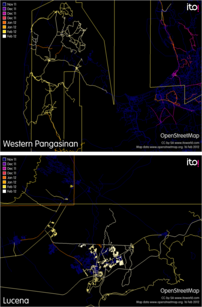
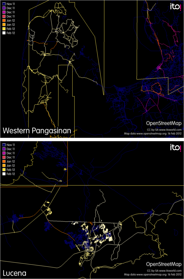
| Description | 2 images exported from ITO World's OSM Mapper showing recent edits in Lucena City and Western Pangasinan as of February 16, 2012. Brighter areas show more recent activity. These edits were a result of newly added Bing aerial imagery. |
|---|---|
| Author | ITO World OSM Mapper (Image generation requested by seav) |
| Source | ITO World OSM Mapper |
| Date | 2012-02-16 |
| Permission | CC-BY-SA 2.0 |
File history
Click on a date/time to view the file as it appeared at that time.
| Date/Time | Thumbnail | Dimensions | User | Comment | |
|---|---|---|---|---|---|
| current | 15:09, 20 February 2012 | | 640 × 970 (295 KB) | Seav (talk | contribs) | ==Information== {{Information |Description = 2 images exported from ITO World's OSM Mapper showing recent edits in Lucena City and Western Pangasinan as of February 16, 2012. Brighter areas show more recent activity. These edits were a result o |
You cannot overwrite this file.
File usage
The following page uses this file: