File:Luxembourg-Admin Boundaries-Esch-City.png
Jump to navigation
Jump to search

Size of this preview: 494 × 600 pixels. Other resolutions: 198 × 240 pixels | 395 × 480 pixels | 632 × 768 pixels | 843 × 1,024 pixels | 1,875 × 2,277 pixels.
Original file (1,875 × 2,277 pixels, file size: 252 KB, MIME type: image/png)
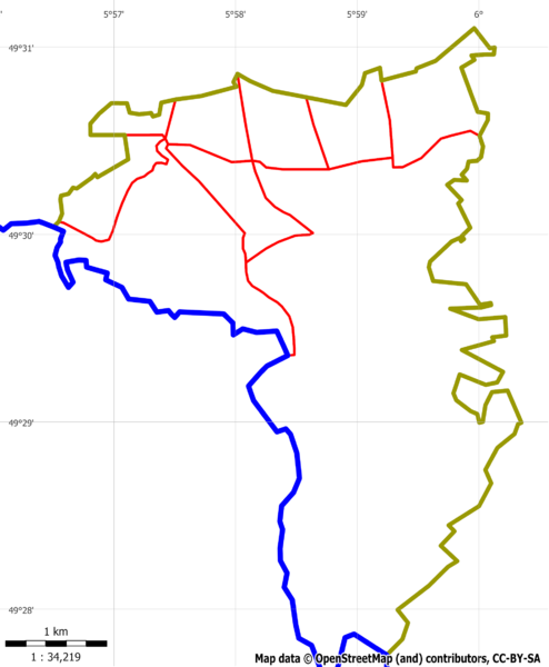
Boundary of Esch-sur-Alzette
![]()
Contains map data © OpenStreetMap contributors, made available under the terms of the Creative Commons Attribution-ShareAlike 2.0 (CC-BY-SA-2.0).
File history
Click on a date/time to view the file as it appeared at that time.
| Date/Time | Thumbnail | Dimensions | User | Comment | |
|---|---|---|---|---|---|
| current | 10:46, 20 January 2011 | | 1,875 × 2,277 (252 KB) | Loll78 (talk | contribs) | |
| 12:57, 6 January 2011 |  | 771 × 784 (52 KB) | Loll78 (talk | contribs) | Boundary of Esch-sur-Alzette |
You cannot overwrite this file.
File usage
The following 2 pages use this file: