File:MNL in X-Plane.png
Jump to navigation
Jump to search


Size of this preview: 800 × 424 pixels. Other resolutions: 320 × 170 pixels | 640 × 339 pixels | 1,024 × 543 pixels.
Original file (1,024 × 543 pixels, file size: 759 KB, MIME type: image/png)
Information
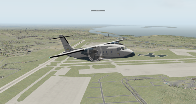
| Description | This shows a frame from the X-Plane flight simulator application depicting the runways of Ninoy Aquino International Airport (NAIA) (IATA: MNL). The roads, water bodies, and many other elements in the scenery were derived from OSM data. |
|---|---|
| Author | Screenshot taken by Jomni |
| Source | "Island Hopping Manila to Iloilo." |
| Date | 2012-03-18 |
| Permission | Fair use |
File history
Click on a date/time to view the file as it appeared at that time.
| Date/Time | Thumbnail | Dimensions | User | Comment | |
|---|---|---|---|---|---|
| current | 16:46, 18 March 2012 | | 1,024 × 543 (759 KB) | Seav (talk | contribs) | ==Information== {{Information |Description = This shows a frame from the X-Planes flight simulator application depicting the runways of Ninoy Aquino International Airport (NAIA) (IATA: MNL). The runways, roads, and many other elements in the scener |
You cannot overwrite this file.
File usage
The following page uses this file: