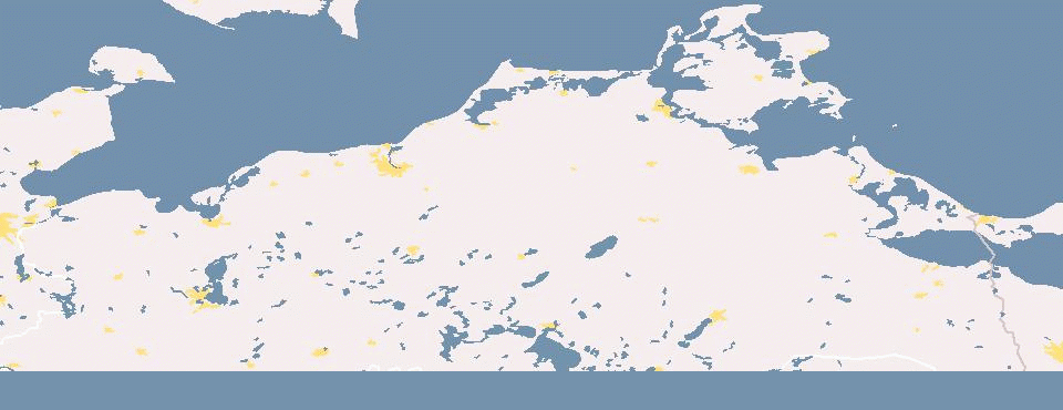
File:MV-history.gif
Jump to navigation
Jump to search


Size of this preview: 800 × 308 pixels. Other resolutions: 320 × 123 pixels | 960 × 370 pixels.
Original file (960 × 370 pixels, file size: 382 KB, MIME type: image/gif, 175 frames, 1 min 28 s)
Note: Due to technical limitations, thumbnails of high resolution GIF images such as this one will not be animated.
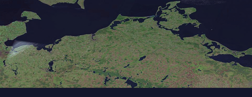
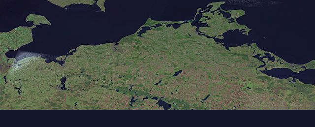
- current state: 01/04/2009
- settings: bbox: 53.3570,10.6864,54.7000,14.5333
- date range: earliest to latest
- created with: http://wiki.openstreetmap.org/index.php/Historical_Coverage
- generate an updated image
File history
Click on a date/time to view the file as it appeared at that time.
| Date/Time | Thumbnail | Dimensions | User | Comment | |
|---|---|---|---|---|---|
| current | 07:52, 30 August 2010 | 960 × 370 (382 KB) | !i! (talk | contribs) | hope fix thumb pro | |
| 07:50, 30 August 2010 | 960 × 370 (357 KB) | !i! (talk | contribs) | problems with thumbs | ||
| 18:09, 29 August 2010 | 960 × 370 (382 KB) | !i! (talk | contribs) | |||
| 17:46, 29 August 2010 | 960 × 370 (363 KB) | !i! (talk | contribs) | |||
| 10:53, 29 August 2010 | 960 × 370 (363 KB) | !i! (talk | contribs) | |||
| 21:02, 22 September 2009 | 960 × 370 (357 KB) | !i! (talk | contribs) | |||
| 17:31, 4 January 2009 | 960 × 370 (292 KB) | Larskr (talk | contribs) | updated history image for MV | ||
| 20:34, 15 January 2008 | 640 × 258 (134 KB) | Larskr (talk | contribs) | * current state: 01/15/2008 * settings: bbox: 53.3570,10.6864,54.7000,14.5333 * date range: earliest to latest * background: landsat * created with: http://wiki.openstreetmap.org/index.php/Historical_Coverage |
You cannot overwrite this file.
File usage
The following page uses this file: