File:Manchester-yahoo-coverage.gif
Jump to navigation
Jump to search

No higher resolution available.
Manchester-yahoo-coverage.gif (465 × 542 pixels, file size: 57 KB, MIME type: image/gif)
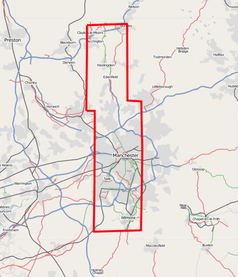
Outline bounds of Yahoo! Aerial Imagery coverage of Manchester
Created by following around the edge of the yahoo imagery on maps.yahoo.com, at 'mag=3' zoom level e.g. Western most edge, drawing the red line in approximately the right place on the map image.
Similar one of London is Image:London-yahoo-coverage.gif
![]()
Contains map data © OpenStreetMap contributors, made available under the terms of the Creative Commons Attribution-ShareAlike 2.0 (CC-BY-SA-2.0).
File history
Click on a date/time to view the file as it appeared at that time.
| Date/Time | Thumbnail | Dimensions | User | Comment | |
|---|---|---|---|---|---|
| current | 00:45, 29 March 2007 | | 465 × 542 (57 KB) | Harry Wood (talk | contribs) | Diagram showing Yahoo! Aerial Imagery coverage of Manchester |
You cannot overwrite this file.
File usage
There are no pages that use this file.