File:Map Poster DSWD Operations Center.jpg
Map_Poster_DSWD_Operations_Center.jpg (720 × 480 pixels, file size: 37 KB, MIME type: image/jpeg)
Summary
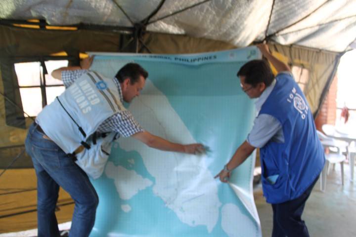
International Organization on Migration (IOM) showing an UN representative a large OSM print of Guiuan, Eastern Samar. This photo was taken in the DSWD Operations Center in Tacloban Airport. The map will be used to coordinate the relief and rescue efforts for the victims/survivors of Typhoon Yolanda/Haiyan. Data is from OpenStreetMap printed using MapOSmatic.org contributed by thousands of OSM volunteers for HOT's Typhoon Ylanda/Haiyan remote mapping activation. Typhoon Haiyan.
Photo by Joe Lowry, Senior Communications Officer and Spokesperson at IOM.
Source:
http://www.flickr.com/photos/esambale/10937514315/ http://creativecommons.org/licenses/by/2.0/deed.en
Licensing
![]()
![]()
Attribution: Joe Lowry, 2013 published on flickr by esambale
File history
Click on a date/time to view the file as it appeared at that time.
| Date/Time | Thumbnail | Dimensions | User | Comment | |
|---|---|---|---|---|---|
| current | 04:06, 21 November 2013 | | 720 × 480 (37 KB) | Maning (talk | contribs) | International Organization on Migration (IOM) showing an UN representative a large OSM print of Guiuan, Eastern Samar. This photo was taken in the DSWD Operations Center in Tacloban Airport. The map will be used to coordinate the relief and rescue effo... |
You cannot overwrite this file.
File usage
The following 8 pages use this file: