File:MaperitiveSRTMComparison.png
Jump to navigation
Jump to search


Size of this preview: 664 × 600 pixels. Other resolutions: 266 × 240 pixels | 532 × 480 pixels | 851 × 768 pixels | 1,248 × 1,127 pixels.
Original file (1,248 × 1,127 pixels, file size: 534 KB, MIME type: image/png)
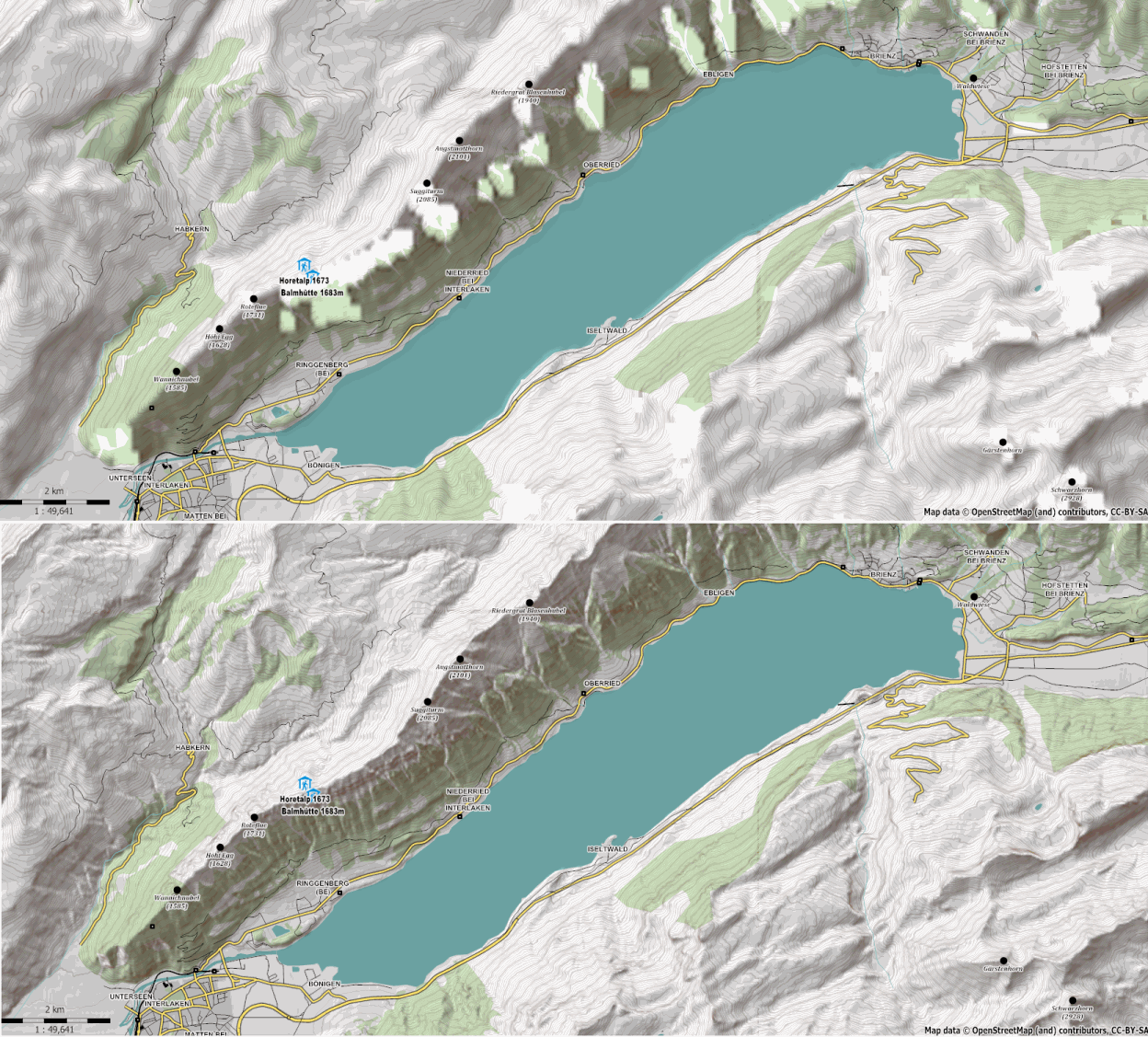
A comparison of contours and hillshading maps made using standard SRTM3 and that of Viewfinder's Alps SRTM1 DEM.
This is a Featured image, which means that it has been identified as one of the best examples of OpenStreetMap mapping, or that it provides a useful illustration of the OpenStreetMap project. If you know another image of similar quality, you can nominate it on Featured image proposals.
Front-page image for week 10 of 2011 (7–13 Mar.).
- Image descriptions
- Deutsch : Vergleich der Ausgaben von Maperitive mit individuellem DEM "Alps SRTM1 DEM" von Viewfinder im Vergleich mit SRTM, für die Gegend um den Brienzersee. (auch zu sehen auf den Topo Karten von [1] [2] [3])
- English : Maperitive's custom DEM support showing detail of Viewfinder's Alps SRTM1 DEM compared to SRTM, for Lake Brienz area. (also visible on [4] [5] [6] topo maps)
- français : Le support DEM adapté de Maperitive montrant des détails de Viewfinder Alpes SRTM1 DEM compraée avec SRTM, pour la région du lac Brienz. (également visible [7] [8] [9] cartes topographiques)
- italiano : Confronto tra il modello digitale di elevazione (DEM) SRTM1 fornito da Viewfinder e quello SRTM delle Alpi, per la zona del Lago di Brienz, realizzato mediante Maperitive. (visibile anche sulle mappe topografiche [10] [11] [12])
File history
Click on a date/time to view the file as it appeared at that time.
| Date/Time | Thumbnail | Dimensions | User | Comment | |
|---|---|---|---|---|---|
| current | 21:53, 25 February 2011 | | 1,248 × 1,127 (534 KB) | Breki (talk | contribs) | A comparison of contours and hillshading maps made using standard SRTM3 and that of Viewfinder's Alps SRTM1 DEM. |
You cannot overwrite this file.
File usage
The following 9 pages use this file: