File:Mapping-Features-Bridge-Road-Connection.png
Jump to navigation
Jump to search

No higher resolution available.
Mapping-Features-Bridge-Road-Connection.png (259 × 542 pixels, file size: 12 KB, MIME type: image/png)
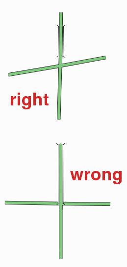
Right and wrong way of connecting a bridge to a road.
File history
Click on a date/time to view the file as it appeared at that time.
| Date/Time | Thumbnail | Dimensions | User | Comment | |
|---|---|---|---|---|---|
| current | 20:03, 31 October 2007 | | 259 × 542 (12 KB) | Etric Celine (talk | contribs) | |
| 17:44, 10 February 2007 | 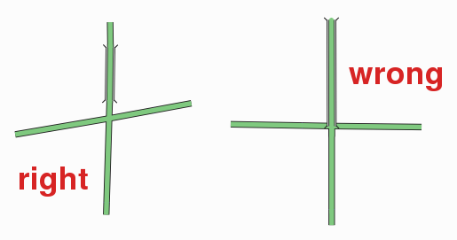 | 515 × 271 (12 KB) | Joto (talk | contribs) | Right and wrong way of connecting a bridge to a road. |
You cannot overwrite this file.
File usage
The following 3 pages use this file: