File:Mapping Event Earthquake Italy.jpg
Jump to navigation
Jump to search


Size of this preview: 800 × 450 pixels. Other resolutions: 320 × 180 pixels | 640 × 360 pixels | 1,024 × 576 pixels.
Original file (1,024 × 576 pixels, file size: 73 KB, MIME type: image/jpeg)
Summary
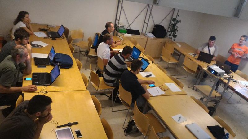
Teaching new OSM users how to map the area hit by the Earthquake. The event was organized by the Wikimedia and OpenStreetMap communities in the City of Trento, Italy.
Photo by Eusebia Parrotto.
This is a Featured image, which means that it has been identified as one of the best examples of OpenStreetMap mapping, or that it provides a useful illustration of the OpenStreetMap project. If you know another image of similar quality, you can nominate it on Featured image proposals.
Front-page image for week 38 of 2016 (19–25 Sep.).
- Image descriptions
- English : A collaborative emergency mapping event organized by the Wikimedia and OpenStreetMap communities in the City of Trento, Italy.
- italiano : Un evento di mappatura collaborativa per le emergenze organizzato dalle comunità di Wikimedia e di OpenStreetMap a Trento.
- русский : Экстренная картовстреча волонтёров Викимедии и ОСМ прошла в итальянском городе Тренто.
- 中文(简体) : 由维基媒体和开放街图社群在义大利特伦托合办的紧急合作画地图活动。
- 中文(繁體) : 由維基媒體和開放街圖社群在義大利特倫托合辦的緊急合作畫地圖活動。
Licensing
![]()
![]()
![]()
This work is licensed under the Creative Commons Attribution-ShareAlike 3.0 License.
Attribution not specified as a parameter! THIS LICENSE ALWAYS REQUIRES ATTRIBUTION! Use {{CC-BY-SA-3.0|Attribution, typically name of author}} See Template:CC-BY-SA-3.0 for full description how this template should be used.
Attribution not specified as a parameter! THIS LICENSE ALWAYS REQUIRES ATTRIBUTION! Use {{CC-BY-SA-3.0|Attribution, typically name of author}} See Template:CC-BY-SA-3.0 for full description how this template should be used.
Related
File history
Click on a date/time to view the file as it appeared at that time.
| Date/Time | Thumbnail | Dimensions | User | Comment | |
|---|---|---|---|---|---|
| current | 16:54, 11 September 2016 | | 1,024 × 576 (73 KB) | Wille (talk | contribs) | Teaching new OSM users how to map the area hit by the Earthquake. The event was organized by the Wikimedia and OpenStreetMap communities in the City of Trento, Italy. |
You cannot overwrite this file.
File usage
The following 9 pages use this file: