File:Marshall County WV in OSM on December 26, 2020.png
Jump to navigation
Jump to search

Size of this preview: 586 × 600 pixels. Other resolutions: 234 × 240 pixels | 469 × 480 pixels.
Original file (800 × 819 pixels, file size: 535 KB, MIME type: image/png)
Summary
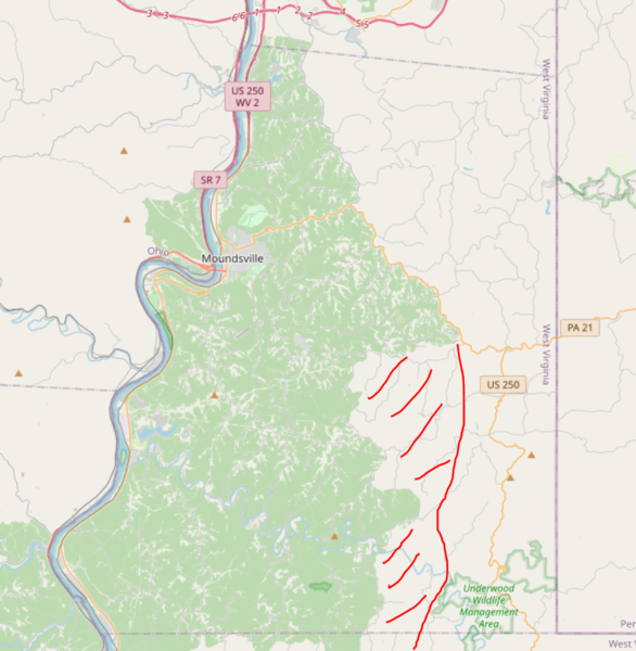
Marshall County, WV in OSM on December 26, 2020. This is the most recent state as of uploading the image. Because in this zoom level not all new modifications are cached, i had to draw the area manually where I did the recent changes.
Licensing
| Contains map data © OpenStreetMap contributors, made available under the terms of the Open Database License (ODbL).
The ODbL does not require any particular license for maps produced from ODbL data, produced maps may be subject also to other licences. |
File history
Click on a date/time to view the file as it appeared at that time.
| Date/Time | Thumbnail | Dimensions | User | Comment | |
|---|---|---|---|---|---|
| current | 10:24, 26 December 2020 | | 800 × 819 (535 KB) | Ottwiz (talk | contribs) |
You cannot overwrite this file.
File usage
The following page uses this file: