File:MassGIS Shaded Relief LiDAR, Assabet River National Wildlife Refuge.jpg

Original file (1,962 × 1,181 pixels, file size: 340 KB, MIME type: image/jpeg)
Summary
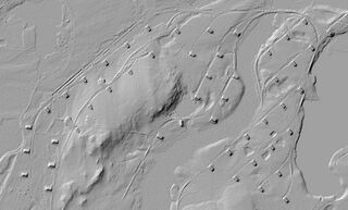
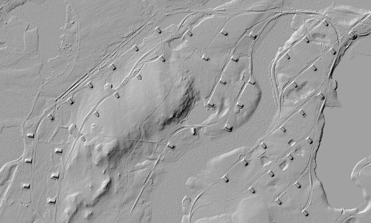
A portion of the Assabet River National Wildlife Refuge, where via shaded relief LiDAR one can see WWII ammo bunkers and railroad tracks, even though these could be hard to find using aerial imagery. The imagery comes from 2021 MassGIS LiDAR Data as can be seen on the MassGIS#LiDAR_Shaded_Relief_2013-2021 imagery and is in the public domain.
Licensing
![]()
In case this is not legally possible, the creator has granted anyone the right to use this work for any purpose, without any conditions, unless such conditions are required by law.
Notice to creator or uploader: CC0 license might be more suitable. "Releasing work to public domain" has some issues, as it is not well defined in some jurisdictions and/or it is not actually possible to "release to public domain". Using CC0 license achieves the intended effect while avoiding such problems and is well suited for media files. Please state the author of this work.
This image is from MassGIS (Bureau of Geographic Information), Commonwealth of Massachusetts EOTSS. Per their Frequently Asked Questions, all their data is released to the public domain and can be used by anyone for any purpose.
File history
Click on a date/time to view the file as it appeared at that time.
| Date/Time | Thumbnail | Dimensions | User | Comment | |
|---|---|---|---|---|---|
| current | 00:34, 1 June 2023 | | 1,962 × 1,181 (340 KB) | PeterCooperJr (talk | contribs) | |
| 15:51, 6 January 2021 |  | 1,022 × 664 (168 KB) | PeterCooperJr (talk | contribs) | A portion of the Assabet River National Wildlife Refuge, where via shaded relief LiDAR one can see WWII ammo bunkers and railroad tracks, even though these could be hard to find using aerial imagery. The LiDAR data comes from [https://docs.digital.mass.gov/dataset/massgis-data-lidar-terrain-data MassGIS LiDAR Data] as can be seen on the MassGIS#MassGIS_LiDAR_Shaded_Relief imagery and is in the public domain. |
You cannot overwrite this file.
File usage
The following page uses this file: