File:Maxbe otm 6332 15 gk4.png
Jump to navigation
Jump to search

Size of this preview: 626 × 600 pixels. Other resolutions: 251 × 240 pixels | 501 × 480 pixels | 811 × 777 pixels.
Original file (811 × 777 pixels, file size: 372 KB, MIME type: image/png)
Summary
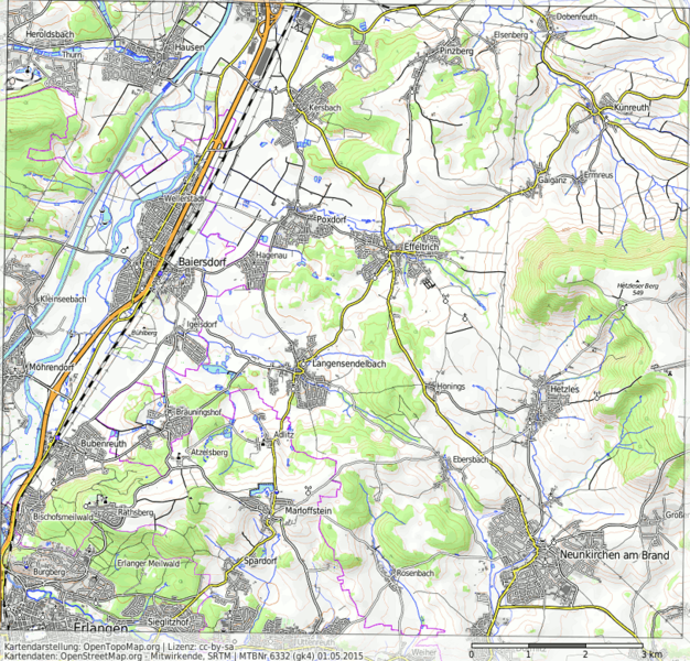
Messtischblatt aus der OpenTopoMap in GK4 mit 15m/px Auflösung Karte: OpenTopoMap
Licensing
![]()
![]()
![]()
This work is licensed under the Creative Commons Attribution-ShareAlike 3.0 License.
Attribution not specified as a parameter! THIS LICENSE ALWAYS REQUIRES ATTRIBUTION! Use {{CC-BY-SA-3.0|Attribution, typically name of author}} See Template:CC-BY-SA-3.0 for full description how this template should be used.
Attribution not specified as a parameter! THIS LICENSE ALWAYS REQUIRES ATTRIBUTION! Use {{CC-BY-SA-3.0|Attribution, typically name of author}} See Template:CC-BY-SA-3.0 for full description how this template should be used.
File history
Click on a date/time to view the file as it appeared at that time.
| Date/Time | Thumbnail | Dimensions | User | Comment | |
|---|---|---|---|---|---|
| current | 22:51, 1 May 2015 | | 811 × 777 (372 KB) | Maxbe (talk | contribs) | Messtischblatt aus der OpenTopoMap in GK4 mit 15m/px Auflösung Karte: OpenTopoMap |
You cannot overwrite this file.
File usage
The following page uses this file: