File:Melton dsm.png
Jump to navigation
Jump to search

Size of this preview: 800 × 477 pixels. Other resolutions: 320 × 191 pixels | 640 × 381 pixels | 915 × 545 pixels.
Original file (915 × 545 pixels, file size: 436 KB, MIME type: image/png)
Summary
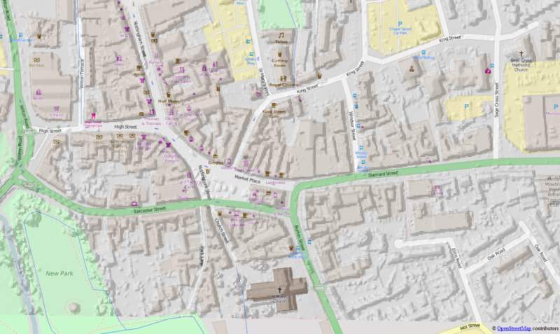
Hillshaded 1m Digital Surface Model of Melton Mowbray towncentre compared with OSM Mapnik. DSM is English Environment Agency LIDAR Open Data released under the OGL, crown copyright and database right 2015. OSM data copyright OSM contributors 2015.
Data can be used to improve accuracy of buildings on OSM.
Licensing
| Contains map data © OpenStreetMap contributors, made available under the terms of the Open Database License (ODbL).
The ODbL does not require any particular license for maps produced from ODbL data, produced maps may be subject also to other licences. |
File history
Click on a date/time to view the file as it appeared at that time.
| Date/Time | Thumbnail | Dimensions | User | Comment | |
|---|---|---|---|---|---|
| current | 12:00, 20 October 2015 | | 915 × 545 (436 KB) | SK53 (talk | contribs) | Hillshaded 1m Digital Surface Model of Melton Mowbray towncentre compared with OSM Mapnik. DSM is Environment Agency Open Data released under the OGL, crown copyright and database right 2015. OSM data copyright OSM contributors 2015. Data can be used... |
You cannot overwrite this file.
File usage
The following page uses this file: