File:Meon-Valley-2007-02-27.png
Jump to navigation
Jump to search

Size of this preview: 564 × 600 pixels. Other resolutions: 226 × 240 pixels | 452 × 480 pixels | 762 × 810 pixels.
Original file (762 × 810 pixels, file size: 157 KB, MIME type: image/png)
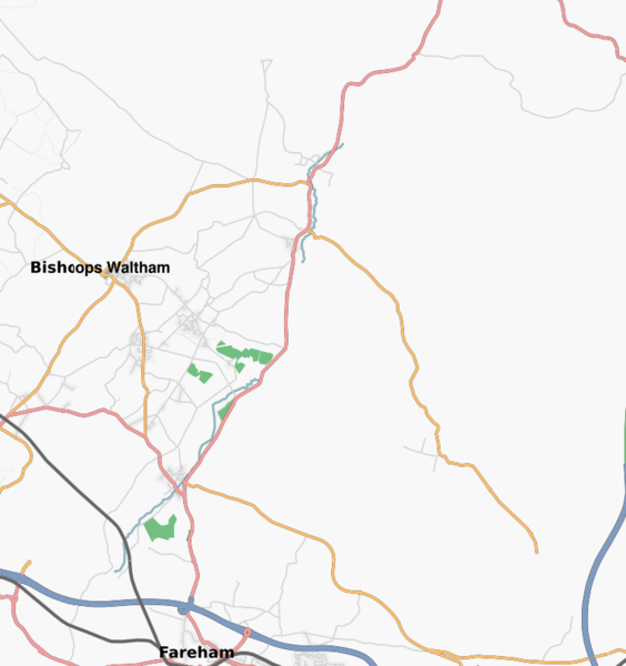
Osmarender map of the Meon Valley in Hampshire.
![]()
Contains map data © OpenStreetMap contributors, made available under the terms of the Creative Commons Attribution-ShareAlike 2.0 (CC-BY-SA-2.0).
File history
Click on a date/time to view the file as it appeared at that time.
| Date/Time | Thumbnail | Dimensions | User | Comment | |
|---|---|---|---|---|---|
| current | 01:16, 27 February 2007 | | 762 × 810 (157 KB) | AndyS (talk | contribs) | Osmarender map of the Meon Valley in Hampshire. |
You cannot overwrite this file.
File usage
The following page uses this file: