File:Multiple landuse example 2.png
Jump to navigation
Jump to search
Size of this preview: 472 × 599 pixels. Other resolutions: 189 × 240 pixels | 378 × 480 pixels | 701 × 890 pixels.
Original file (701 × 890 pixels, file size: 796 KB, MIME type: image/png)
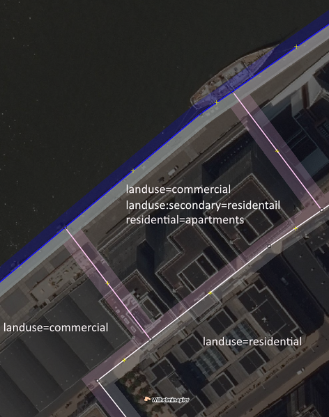
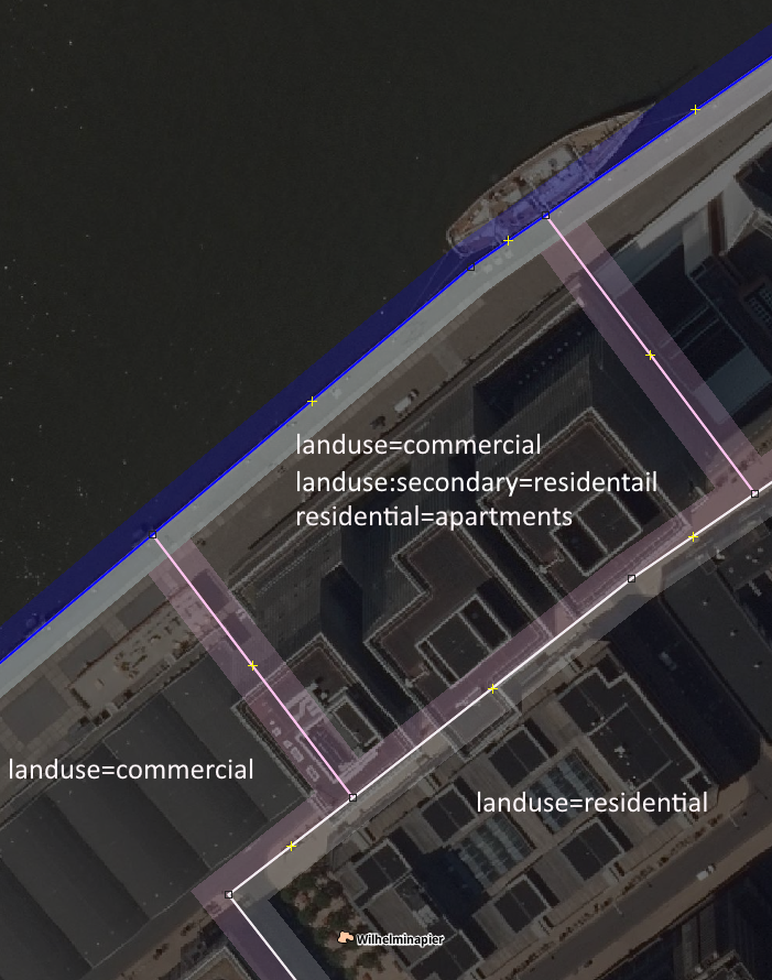
This second examples shows how to use the dual landuse
The imagery used is from PDOK. It is the National data provider [1]. It is provided under CC-BY 4.0 [1]
![]()
![]()
This work is licensed under the Creative Commons Attribution 4.0 License.
Attribution: PDOK
Attribution: PDOK
File history
Click on a date/time to view the file as it appeared at that time.
| Date/Time | Thumbnail | Dimensions | User | Comment | |
|---|---|---|---|---|---|
| current | 15:10, 25 September 2021 | | 701 × 890 (796 KB) | Cartographer10 (talk | contribs) | |
| 17:44, 4 August 2021 |  | 701 × 890 (796 KB) | Cartographer10 (talk | contribs) | ||
| 09:26, 2 August 2021 | 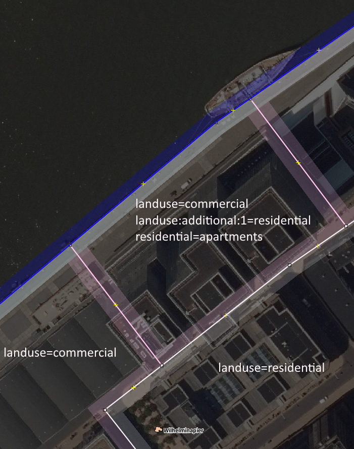 | 701 × 890 (796 KB) | Cartographer10 (talk | contribs) |
You cannot overwrite this file.
File usage
The following 2 pages use this file: