File:Mvey0290.jpg
Jump to navigation
Jump to search


Size of this preview: 800 × 524 pixels. Other resolutions: 320 × 210 pixels | 640 × 419 pixels | 1,024 × 671 pixels | 1,280 × 838 pixels | 1,808 × 1,184 pixels.
Original file (1,808 × 1,184 pixels, file size: 1.35 MB, MIME type: image/jpeg)
This file and its description are from Wikimedia Commons.
Summary
| Description |
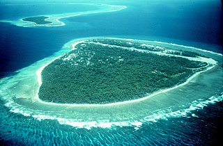
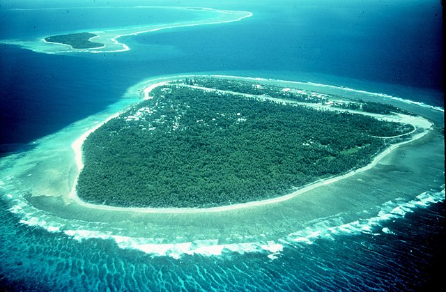
English: Portion of a Pacific atoll (Yap) showing two islets on the ribbon or barrier reef separated by a deep pass between the ocean and the lagoon. |
| Date | |
| Source | Taken from http://www.photolib.noaa.gov/htmls/mvey0290.htm |
| Author | Mr. Ben Mieremet, Senior Advisor OSD, NOAA |
Licensing
This image is in the public domain because it contains materials that originally came from the U.S. National Oceanic and Atmospheric Administration, taken or made as part of an employee's official duties.
|
File history
Click on a date/time to view the file as it appeared at that time.
| Date/Time | Thumbnail | Dimensions | User | Comment | |
|---|---|---|---|---|---|
| current | 21:30, 27 July 2005 | | 1,808 × 1,184 (1.35 MB) | wikimediacommons>Dodo | Portion of a Pacific atoll showing two islets on the ribbon or barrier reef separated by a deep pass betwen the ocean and the lagoon. Taken from http://www.photolib.noaa.gov/mvey/mvey0290.htm {{PD-USGov-NOAA}} |
File usage
The following 5 pages use this file: