File:Mynydd Rhiw Mapbox Imagery 2021Nov.jpg
Original file (1,024 × 768 pixels, file size: 431 KB, MIME type: image/jpeg)
Summary
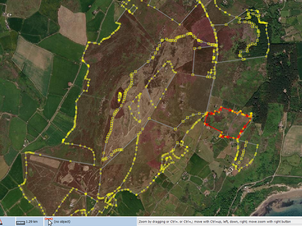
A screenshot of Mapbox Imagery of Mynydd Rhiw with Phase 1 heath polygons overlaid. This image was captured to enable discussion of some interpretation issues of the different imagery layers available. This imagery appears to be very similar, or identical to ESRI & Maxar layers, and therefore is probably sourced from Maxar. It appears to be earlier than 2018 because the forest area extends to the edge of the image but other dated layers from this year show no forest there.
Licensing
![]()
![]()
![]()
The Mapbox imagery is not open licensed, but is made available to the OpenStreetMap project for deriving open licensed map data (see Mapbox page for details). This image is used for illustrative purposes on the OpenStreetMap wiki, to help document ways of using and interpreting the imagery in the OpenStreetMap mapping process and is used here with Mapbox's express permission for that purpose.
| Contains map data © OpenStreetMap contributors, made available under the terms of the Open Database License (ODbL).
The ODbL does not require any particular license for maps produced from ODbL data, produced maps may be subject also to other licences. |
File history
Click on a date/time to view the file as it appeared at that time.
| Date/Time | Thumbnail | Dimensions | User | Comment | |
|---|---|---|---|---|---|
| current | 20:59, 18 November 2021 | | 1,024 × 768 (431 KB) | SK53 (talk | contribs) | A screenshot of Mapbox Imagery of Mynydd Rhiw with Phase 1 heath polygons overlaid. This image was captured to enable discussion of some interpretation issues of the different imagery layers available. This imagery appears to be very similar, or identical to ESRI & Maxar layers, and therefore is probably sourced from Maxar. It appears to be earlier than 2018 because the forest area extends to the edge of the image but other dated layers from this year show no forest there. |
You cannot overwrite this file.
File usage
The following page uses this file:
- File:Mynydd Rhiw ESRI Imagery 2021Nov.jpg (file redirect)