File:NRW-Atlas ALKIS mit JOSM.png
Jump to navigation
Jump to search

No higher resolution available.
NRW-Atlas_ALKIS_mit_JOSM.png (617 × 542 pixels, file size: 191 KB, MIME type: image/png)
Summary
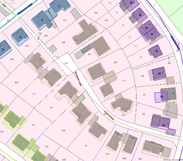
Amtliches Liegenschaftskatasterinformationssystem (ALKIS) aus dem NRW Atlas in Verbindung mit OSM Daten und dem Kartenstil Coloured Streets. Ort: Haan, NRW, Deutschland
Licensing
![]()
![]()
![]()
This work is licensed under the Creative Commons Attribution-ShareAlike 3.0 License.
Attribution not specified as a parameter! THIS LICENSE ALWAYS REQUIRES ATTRIBUTION! Use {{CC-BY-SA-3.0|Attribution, typically name of author}} See Template:CC-BY-SA-3.0 for full description how this template should be used.
Attribution not specified as a parameter! THIS LICENSE ALWAYS REQUIRES ATTRIBUTION! Use {{CC-BY-SA-3.0|Attribution, typically name of author}} See Template:CC-BY-SA-3.0 for full description how this template should be used.
File history
Click on a date/time to view the file as it appeared at that time.
| Date/Time | Thumbnail | Dimensions | User | Comment | |
|---|---|---|---|---|---|
| current | 16:06, 14 June 2015 | | 617 × 542 (191 KB) | Zyras (talk | contribs) | Automatisierte Liegenschaftskarte ALKIS aus dem NRW Atlas in Verbindung mit OSM Daten und dem Kartenstil Coloured Streets. Ort: Haan, NRW, Deutschland |
You cannot overwrite this file.
File usage
The following page uses this file: