File:NY-motorways-all.png
Jump to navigation
Jump to search


Size of this preview: 724 × 599 pixels. Other resolutions: 290 × 240 pixels | 580 × 480 pixels | 928 × 768 pixels | 1,237 × 1,024 pixels | 1,474 × 1,220 pixels.
Original file (1,474 × 1,220 pixels, file size: 1.53 MB, MIME type: image/png)
Summary
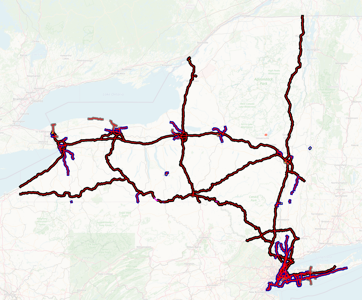
Map showing all motorways in New York State, as defined as NYS DOT feature classes A10 through A18 (red), together with a couple of trunk links with arterial class 1 (magenta).
Casing colour indicates arterial class code - black=1 (national significance), blue=2 (regional significance); grey=3 and below.
Licensing
![]()
This file has been released into the public domain by the copyright holder, its copyright has expired, or it is ineligible for copyright. This applies worldwide.
Please, please use more specific template such as {{PD-self}} / {{PD-creator}} / {{PD-shape}} / {{PD-USGov}} / {{PD-old}} / {{PD-RU-exempt}} ... This template is not making clear why this work is in the public domain.
Please, please use more specific template such as {{PD-self}} / {{PD-creator}} / {{PD-shape}} / {{PD-USGov}} / {{PD-old}} / {{PD-RU-exempt}} ... This template is not making clear why this work is in the public domain.
| Contains map data © OpenStreetMap contributors, made available under the terms of the Open Database License (ODbL).
The ODbL does not require any particular license for maps produced from ODbL data, produced maps may be subject also to other licences. |
File history
Click on a date/time to view the file as it appeared at that time.
| Date/Time | Thumbnail | Dimensions | User | Comment | |
|---|---|---|---|---|---|
| current | 02:54, 6 September 2021 | | 1,474 × 1,220 (1.53 MB) | Ke9tv (talk | contribs) | Map showing all motorways in New York State, as defined as NYS DOT feature classes A10 through A18 (red), together with a couple of trunk links with arterial class 1 (magenta). Casing colour indicates arterial class code - black=1 (national significance), blue=2 (regional significance); grey=3 and below. |
You cannot overwrite this file.
File usage
The following page uses this file: